MyTopo
Riceville Montana US Topo Map
Couldn't load pickup availability
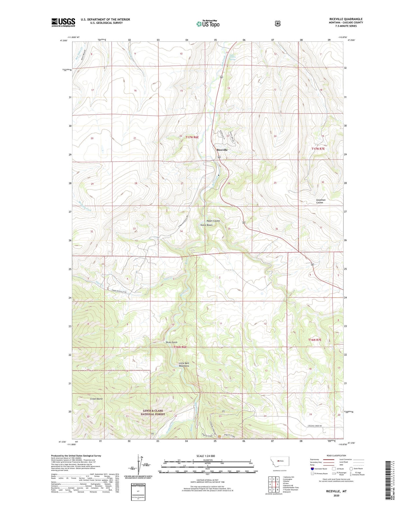
2020 topographic map quadrangle Riceville in the state of Montana. Scale: 1:24000. Based on the newly updated USGS 7.5' US Topo map series, this map is in the following counties: Cascade. The map contains contour data, water features, and other items you are used to seeing on USGS maps, but also has updated roads and other features. This is the next generation of topographic maps. Printed on high-quality waterproof paper with UV fade-resistant inks.
Quads adjacent to this one:
West: Evans
Northwest: Mahoney Hill
North: Armington
Northeast: Blythe
East: Monarch NE
Southeast: Monarch
South: Thunder Mountain
Southwest: Blankenbaker Flats
Contains the following named places: A C M Company Spur, Albright, Albright Post Office, Camp Don Bosco, Campsite Post Office, Crown Butte, Dicks Gulch, Isaac Walton Spring, Limestone Spar, Logging Creek, Logging Creek Post Office, Nasen Coulee, Riceville, Riceville Census Designated Place, Riceville Post Office, Sluice Boxes, Tiger Creek