MyTopo
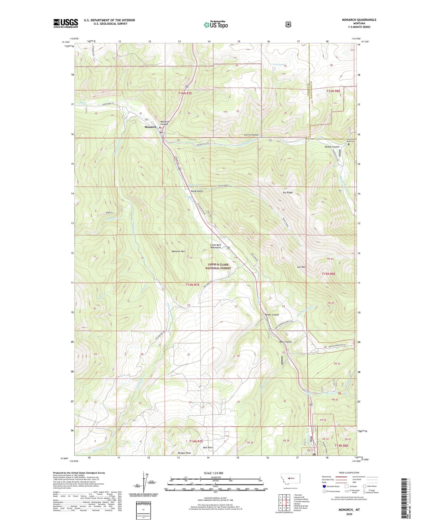
Monarch Montana US Topo Map
Couldn't load pickup availability
Also explore the Monarch Forest Service Topo of this same quad for updated USFS data
2024 topographic map quadrangle Monarch in the state of Montana. Scale: 1:24000. Based on the newly updated USGS 7.5' US Topo map series, this map is in the following counties: Cascade, Judith Basin. The map contains contour data, water features, and other items you are used to seeing on USGS maps, but also has updated roads and other features. This is the next generation of topographic maps. Printed on high-quality waterproof paper with UV fade-resistant inks.
Quads adjacent to this one:
West: Thunder Mountain
Northwest: Riceville
North: Monarch NE
Northeast: Limestone Butte
East: Barker
Southeast: Neihart
South: Belt Park Butte
Southwest: Bubbling Springs
This map covers the same area as the classic USGS quad with code o47110a7.
Contains the following named places: Bear Coulee, Belt Creek Ranger Station, Belt Park, Belt Park School, Benton, Bull Roaring Creek, Burgys Spur, Camp Rotary, Crawford Creek, Currie Coulee, Currie Spring, DAV Park, Dry Fork Belt Creek, Dry Fork Road Cemetery, Dry Ridge, Hoover Creek, Hunt Creek, James Creek, Joice Creek, McGee Coulee, Monarch, Monarch Canyon, Monarch Census Designated Place, Monarch Mountain, Monarch Post Office, Monarch School, Monarch Volunteer Fire Department, Monarch-Neihart Division, NW NW Section 3 Mine, Paine Gulch, Paine Spring, Power Coulee, Power Coulee Quarry, Rafferty Creek, Rocky Mountain Elevator, Ruby Creek, Saint Clement Church, Saint Thomas Camp, Sun Mountain, Thunder Creek, Tillinghast, Tillinghast Creek, United Methodist Church, Yule School, Yules Spur, Yuleville, ZIP Code: 59463