
MyTopo
Rocky Boy Montana US Topo Map
Couldn't load pickup availability
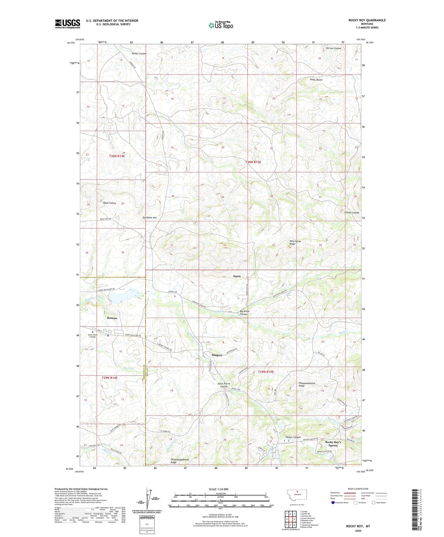
2020 topographic map quadrangle Rocky Boy in the state of Montana. Scale: 1:24000. Based on the newly updated USGS 7.5' US Topo map series, this map is in the following counties: Hill, Chouteau. The map contains contour data, water features, and other items you are used to seeing on USGS maps, but also has updated roads and other features. This is the next generation of topographic maps. Printed on high-quality waterproof paper with UV fade-resistant inks.
Quads adjacent to this one:
West: Cowan Reservoir
Northwest: Laredo
North: Laredo NE
Northeast: Cement Hill
East: Bearpaw Lake
Southeast: Bowery Peak
South: Centennial Mountain
Southwest: Table Butte
Contains the following named places: Azure, Azure Census Designated Place, Big Knife Coulee, Boneau, Boneau Census Designated Place, Boneau Reservoir, Bonneau Dam, Champagne Ranch, Chippewa Tribal Police Department, Daychild Creek, Gardipee Hill, Keifer Coulee, Our Savior Lutheran Church, Parker Canyon, Pasquowmustus Ridge, Piney Butte, Rocky Boy Post Office, Rocky Boy School, Rocky Boy's Agency, Rocky Boy's Agency Census Designated Place, Rocky Boy's Division, Rocky Boy's Reservation, Saint Mary Church, Saint Pierre Coulee, Sangrey, Sangrey Census Designated Place, Sangrey School, Stone Child College, Sundance Creek, Wild Horse Ridge, Wolf Creek


