MyTopo
Cowan Reservoir Montana US Topo Map
Couldn't load pickup availability
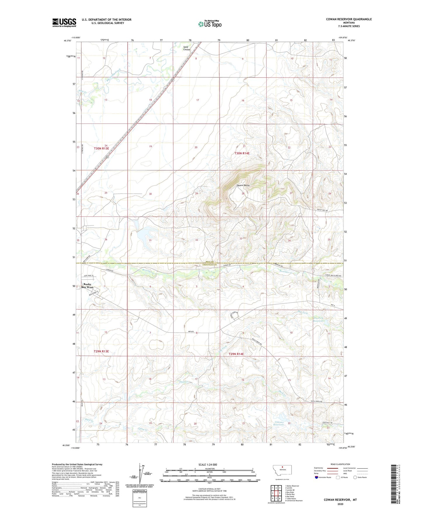
2024 topographic map quadrangle Cowan Reservoir in the state of Montana. Scale: 1:24000. Based on the newly updated USGS 7.5' US Topo map series, this map is in the following counties: Hill, Chouteau. The map contains contour data, water features, and other items you are used to seeing on USGS maps, but also has updated roads and other features. This is the next generation of topographic maps. Printed on high-quality waterproof paper with UV fade-resistant inks.
Quads adjacent to this one:
West: Box Elder
Northwest: Bailey Reservoir
North: Laredo
Northeast: Laredo NE
East: Rocky Boy
Southeast: Centennial Mountain
South: Table Butte
Southwest: Big Sandy
This map covers the same area as the classic USGS quad with code o48109c8.
Contains the following named places: 30N14E08BD__01 Well, 30N14E17BA__01 Well, 59521, Brown Dam, Camp Creek, Cowan Reservoir, Cowan Reservoir Dam, Deucalton Dam, Didache Dam, Dry Fork, Dry Fork Reservoir, Filbert, Peephole Dam, Rocky Boy West Census Designated Place, Sage Creek, Sand Coulee, Square Butte, Tow Dam, Ugly Dam