MyTopo
Laredo Montana US Topo Map
Couldn't load pickup availability
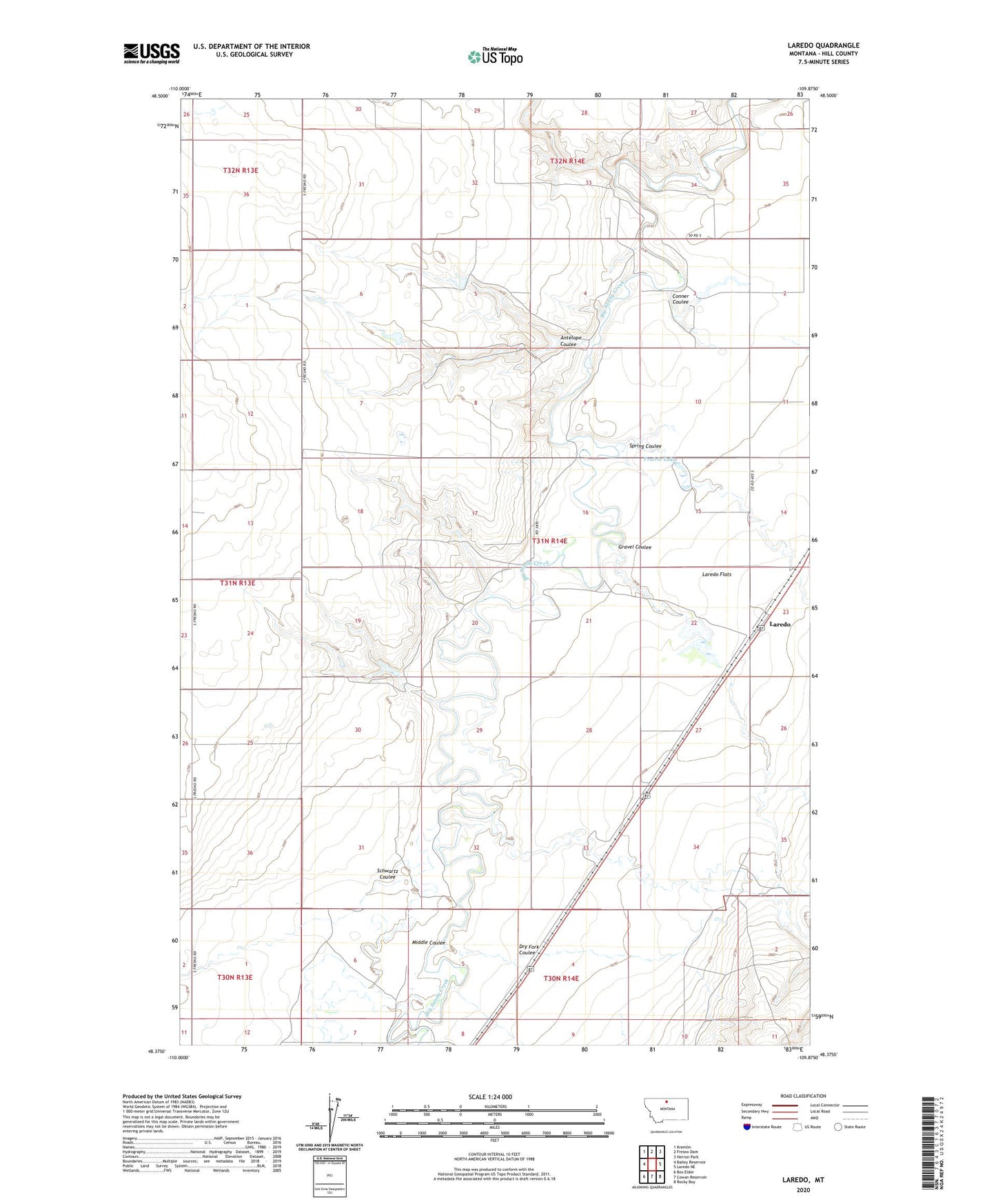
2024 topographic map quadrangle Laredo in the state of Montana. Scale: 1:24000. Based on the newly updated USGS 7.5' US Topo map series, this map is in the following counties: Hill. The map contains contour data, water features, and other items you are used to seeing on USGS maps, but also has updated roads and other features. This is the next generation of topographic maps. Printed on high-quality waterproof paper with UV fade-resistant inks.
Quads adjacent to this one:
West: Bailey Reservoir
Northwest: Kremlin
North: Fresno Dam
Northeast: Herron Park
East: Laredo NE
Southeast: Rocky Boy
South: Cowan Reservoir
Southwest: Box Elder
This map covers the same area as the classic USGS quad with code o48109d8.
Contains the following named places: 31N14E02BA__01 Well, 31N14E03CDDC01 Well, 31N14E15BA__01 Well, 31N14E15DD__01 Well, 31N14E23BC__01 Well, 31N14E23BC__02 Well, 31N14E23CC__01 Well, 31N14E32DC__01 Well, 31N14E33BC__01 Well, 31N14E34AA__01 Well, 32N14E33DD__01 Well, Antelope Coulee, Big Gravel Dam Number 1, Big Jugs Dam, Boyer Dam, Conner Coulee, Daniel Number 1 Dam, Daniel Number 2 Dam, Daniel Number 3 Dam, Dry Fork Coulee, Gravel Coulee, Laredo, Laredo Census Designated Place, Laredo Flats, Laredo Post Office, Laredo School, Middle Coulee, Prairie Lake, Schwartz Coulee, Spring Coulee, Wilfred Tow Dam