MyTopo
Laredo NE Montana US Topo Map
Couldn't load pickup availability
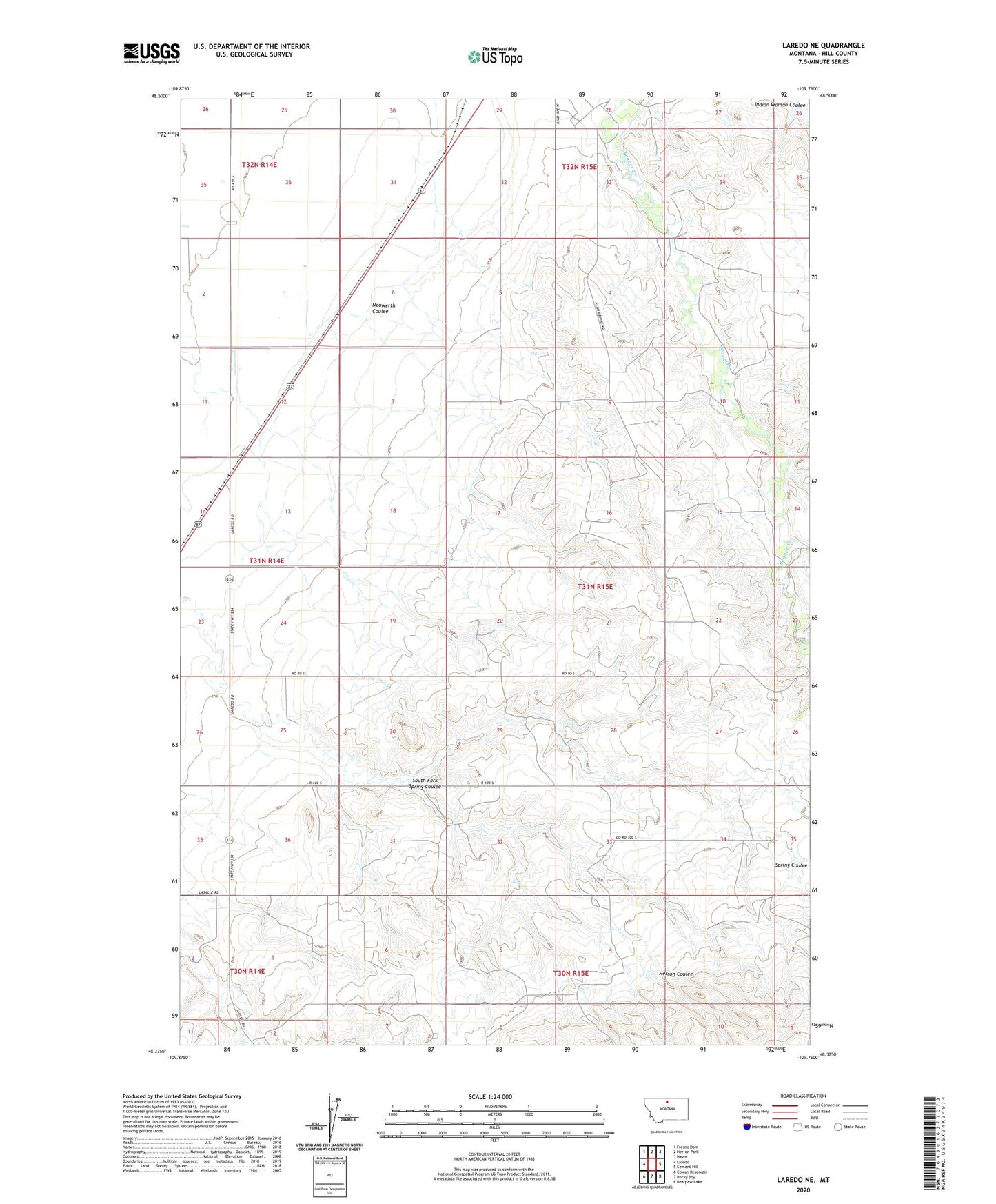
2024 topographic map quadrangle Laredo NE in the state of Montana. Scale: 1:24000. Based on the newly updated USGS 7.5' US Topo map series, this map is in the following counties: Hill. The map contains contour data, water features, and other items you are used to seeing on USGS maps, but also has updated roads and other features. This is the next generation of topographic maps. Printed on high-quality waterproof paper with UV fade-resistant inks.
Quads adjacent to this one:
West: Laredo
Northwest: Fresno Dam
North: Herron Park
Northeast: Havre
East: Cement Hill
Southeast: Bearpaw Lake
South: Rocky Boy
Southwest: Cowan Reservoir
This map covers the same area as the classic USGS quad with code o48109d7.
Contains the following named places: 31N14E12CB__01 Well, 31N14E13AD__01 Well, 31N14E13BC__01 Well, 31N14E23AC__01 Well, 31N15E04CCCD01 Well, 31N15E05AB__01 Well, 31N15E06AD__01 Well, 31N15E08AB__01 Well, 31N15E17ACCC01 Well, 31N15E34CCCB01 Well, 32N14E35AD__01 Well, 32N15E30DC__01 Well, 32N15E31CC__01 Well, 32N15E32DB__01 Well, Chapel at Fort Assinniboine, Herron Coulee, Neuwerth Coulee, South Fork Spring Coulee