
MyTopo
Ruskosky Ridge Montana US Topo Map
Couldn't load pickup availability
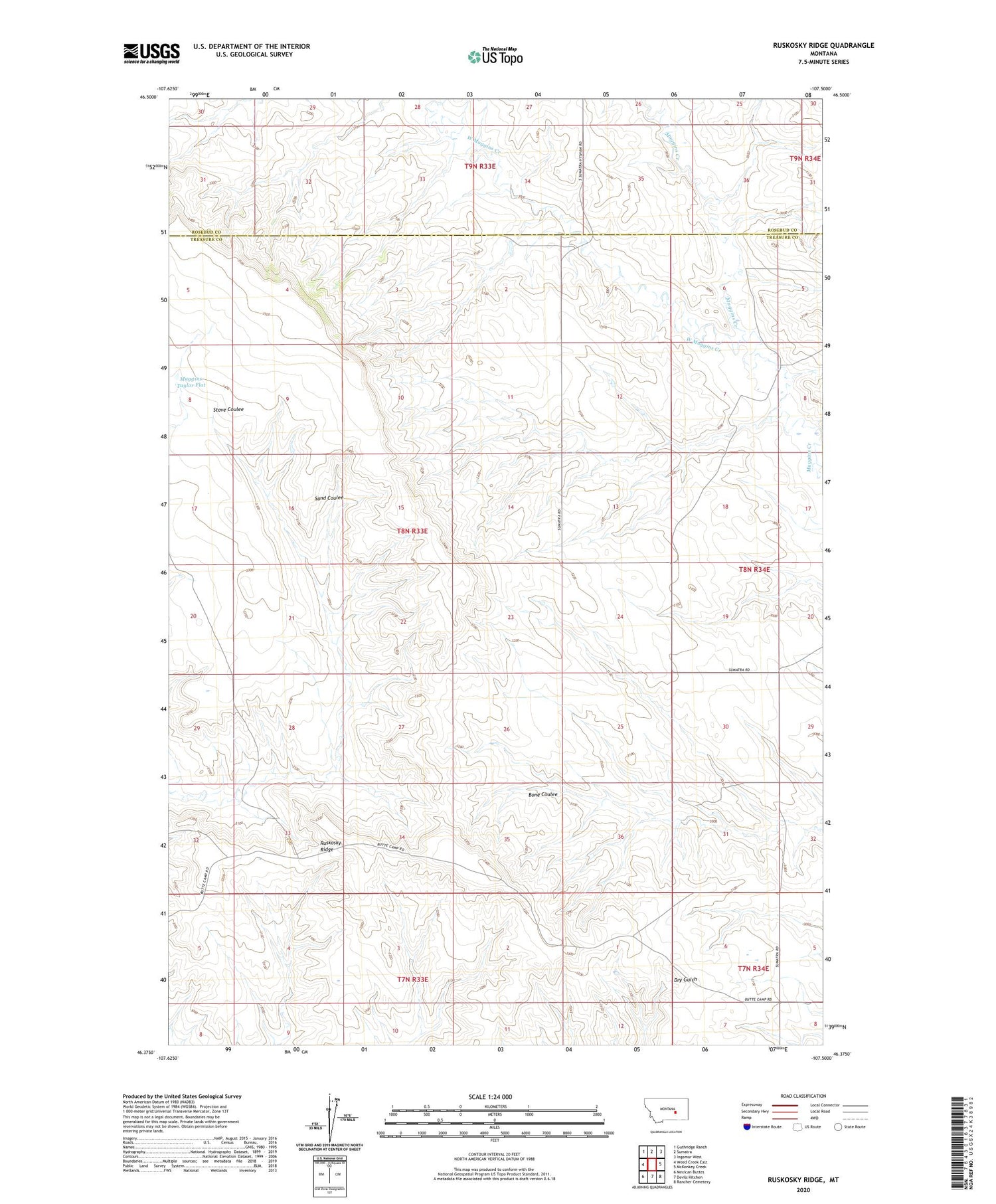
2020 topographic map quadrangle Ruskosky Ridge in the state of Montana. Scale: 1:24000. Based on the newly updated USGS 7.5' US Topo map series, this map is in the following counties: Treasure, Rosebud. The map contains contour data, water features, and other items you are used to seeing on USGS maps, but also has updated roads and other features. This is the next generation of topographic maps. Printed on high-quality waterproof paper with UV fade-resistant inks.
Quads adjacent to this one:
West: Weed Creek East
Northwest: Guthridge Ranch
North: Sumatra
Northeast: Ingomar West
East: McKonkey Creek
Southeast: Rancher Cemetery
South: Devils Kitchen
Southwest: Mexican Buttes
Contains the following named places: 08N33E12CBBD01 Well, 08N33E23BDCD01 Well, 08N33E26A___01 Well, 08N34E06DBAB01 Well, Bone Coulee, Burch School, Liberty Valley School, Muggins Taylor Flat, Ruskosky Ridge, Van Wright School, West Muggins Creek


