MyTopo
Sadie Coulee Montana US Topo Map
Couldn't load pickup availability
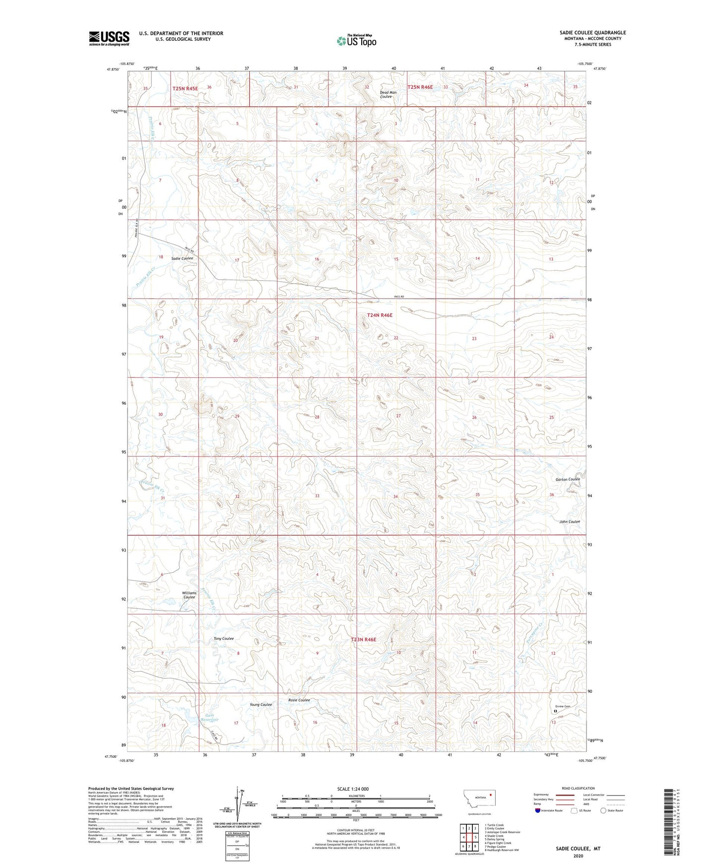
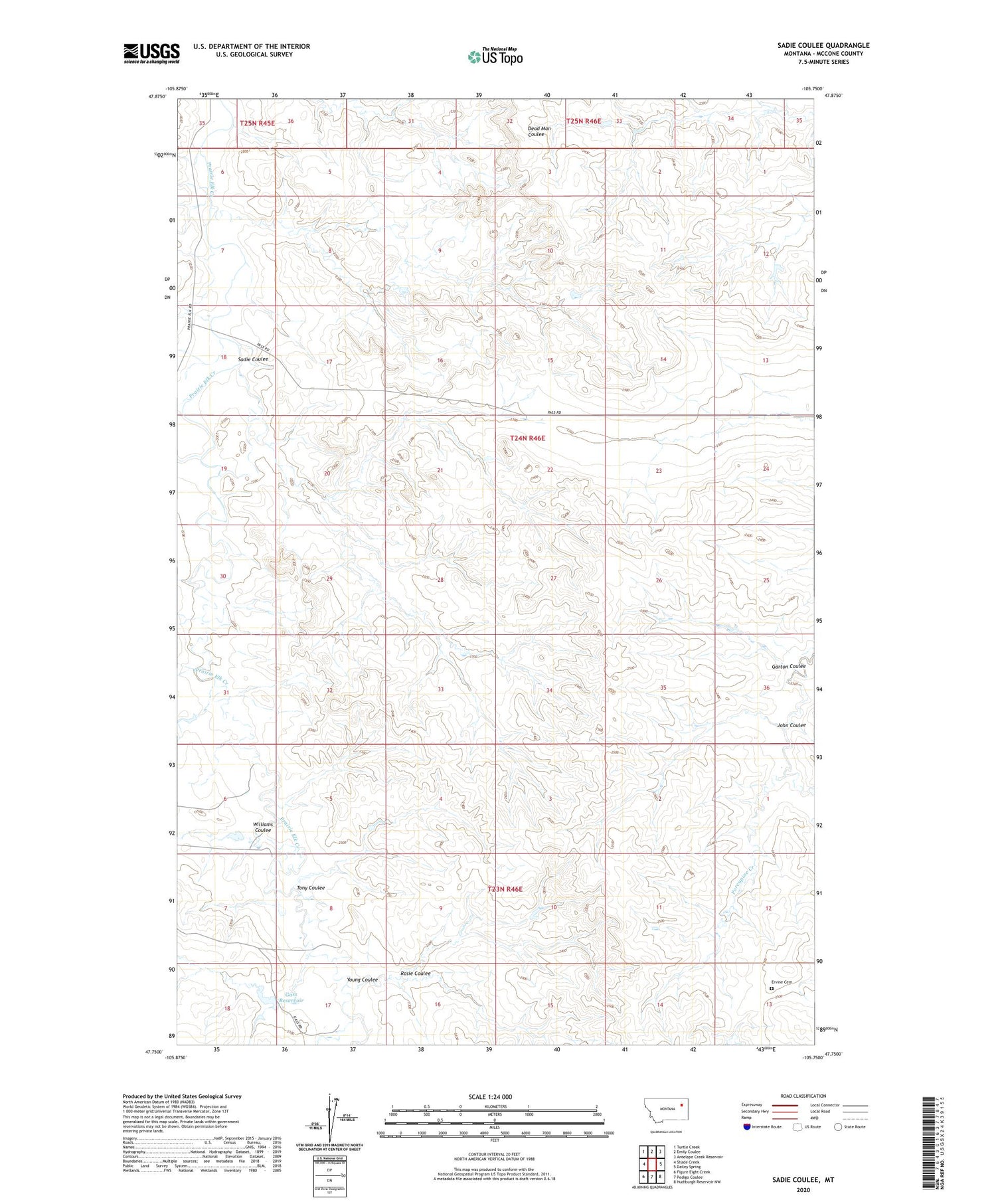
2020 topographic map quadrangle Sadie Coulee in the state of Montana. Scale: 1:24000. Based on the newly updated USGS 7.5' US Topo map series, this map is in the following counties: McCone. The map contains contour data, water features, and other items you are used to seeing on USGS maps, but also has updated roads and other features. This is the next generation of topographic maps. Printed on high-quality waterproof paper with UV fade-resistant inks.
Quads adjacent to this one:
West: Shade Creek
Northwest: Turtle Creek
North: Emily Coulee
Northeast: Antelope Creek Reservoir
East: Dailey Spring
Southeast: Hudiburgh Reservoir NW
South: Pedigo Coulee
Southwest: Figure Eight Creek
Contains the following named places: 23N46E03C___01 Well, 23N46E05CCCC01 Well, 24N46E17CDBD01 Well, 24N46E23BADA01 Well, 24N46E26CD__01 Well, Ervine Cemetery, Garton Coulee, Gass Reservoir, John Coulee, North McCone Division, Prairie Elk, Prairie Elk Post Office, Rosie Coulee, Sadie Coulee, Shade Creek, Tony Coulee, Wendell Number 1 Dam, Williams Coulee, Young Coulee