MyTopo
Antelope Creek Reservoir Montana US Topo Map
Couldn't load pickup availability
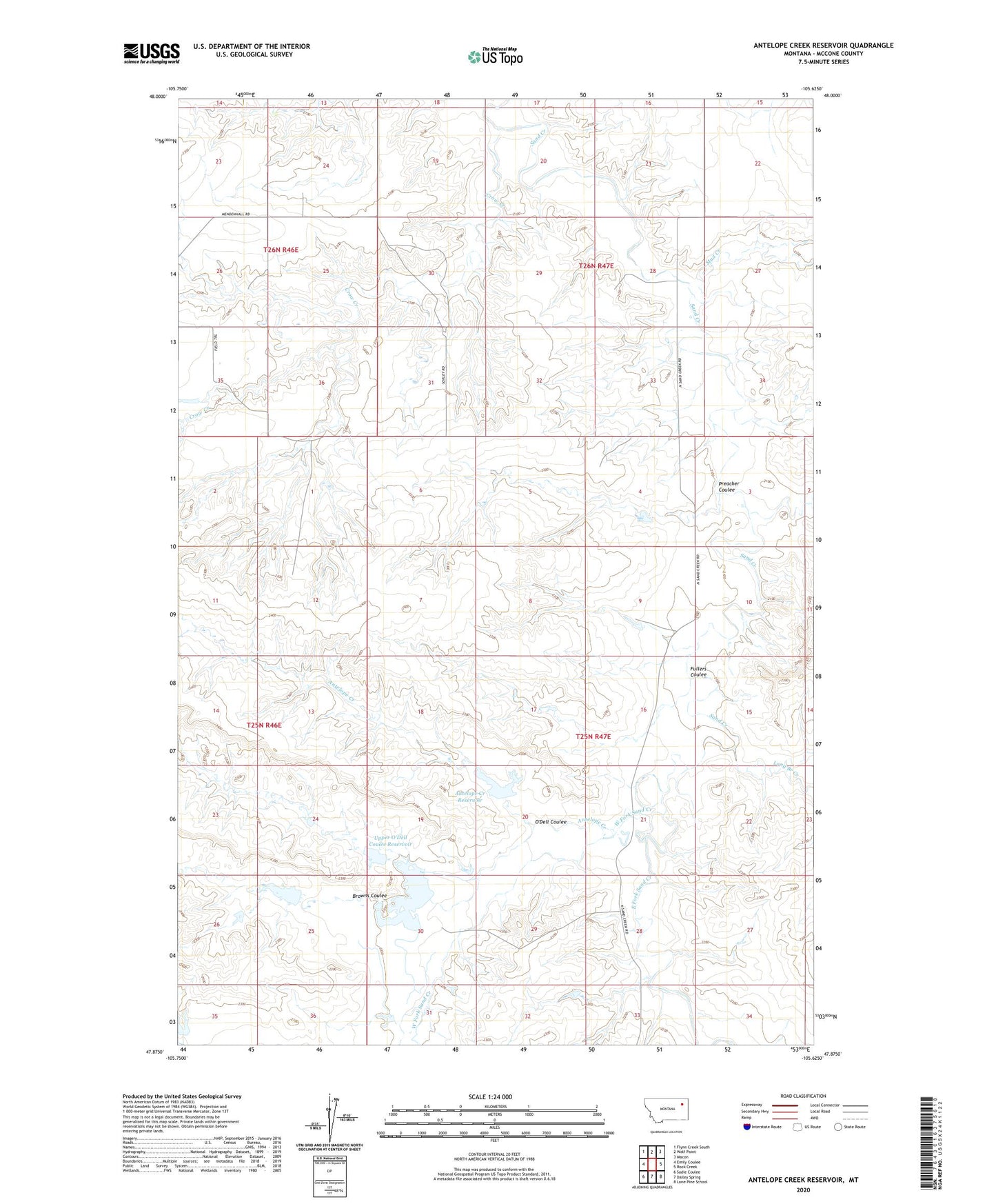
2024 topographic map quadrangle Antelope Creek Reservoir in the state of Montana. Scale: 1:24000. Based on the newly updated USGS 7.5' US Topo map series, this map is in the following counties: McCone. The map contains contour data, water features, and other items you are used to seeing on USGS maps, but also has updated roads and other features. This is the next generation of topographic maps. Printed on high-quality waterproof paper with UV fade-resistant inks.
Quads adjacent to this one:
West: Emily Coulee
Northwest: Flynn Creek South
North: Wolf Point
Northeast: Macon
East: Rock Creek
Southeast: Lone Pine School
South: Dailey Spring
Southwest: Sadie Coulee
This map covers the same area as the classic USGS quad with code o47105h6.
Contains the following named places: 14N48E08BCCD01 Well, 25N46E01DBAA01 Well, 25N46E02BD__01 Well, 25N47E04DAAB01 Well, 25N47E07BBDA01 Well, 25N47E30ACCD01 Well, 26N47E30ACCD01 Well, Ace of Spades Dam, Antelope Creek, Antelope Creek Reservoir, Browns Coulee, Browns Coulee Reservoir, Crow Creek, Dealers Choice Dam, East Fork Sand Creek, Fullers Coulee, Long Branch Creek, Mud Creek, O'Dell Coulee, O'Dell Coulee Reservoir, Preacher Coulee, Rock Creek, T and S Stock Company Number 3 Dam, T and S Stock Company Number 4 Dam, T and S Stock Company Number 5 Dam, Upper O'Dell Coulee Reservoir, West Fork Sand Creek