MyTopo
Dailey Spring Montana US Topo Map
Couldn't load pickup availability
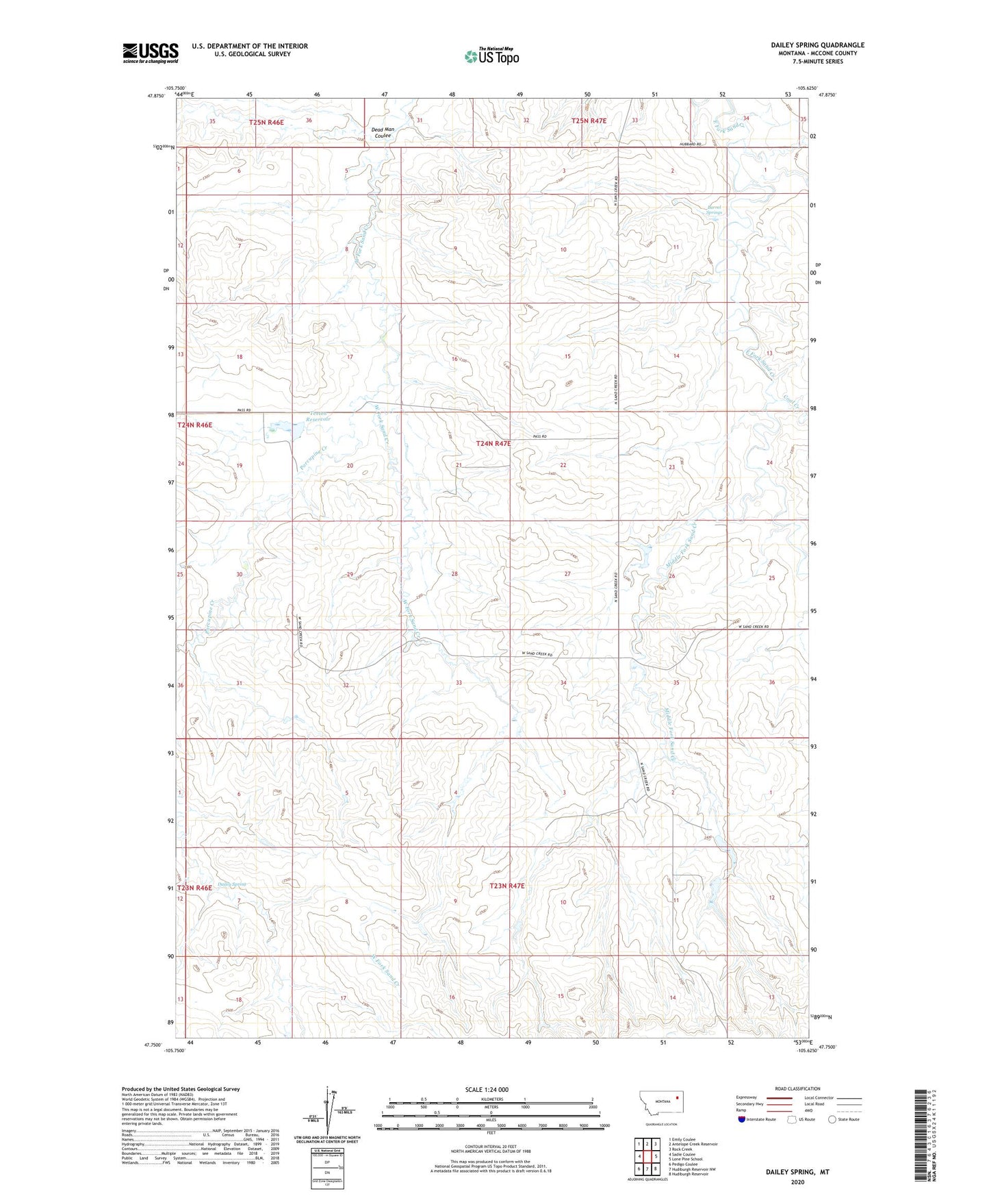
2024 topographic map quadrangle Dailey Spring in the state of Montana. Scale: 1:24000. Based on the newly updated USGS 7.5' US Topo map series, this map is in the following counties: McCone. The map contains contour data, water features, and other items you are used to seeing on USGS maps, but also has updated roads and other features. This is the next generation of topographic maps. Printed on high-quality waterproof paper with UV fade-resistant inks.
Quads adjacent to this one:
West: Sadie Coulee
Northwest: Emily Coulee
North: Antelope Creek Reservoir
Northeast: Rock Creek
East: Lone Pine School
Southeast: Hudiburgh Reservoir
South: Hudiburgh Reservoir NW
Southwest: Pedigo Coulee
This map covers the same area as the classic USGS quad with code o47105g6.
Contains the following named places: 24N47E18CB__01 Well, 24N47E35BBBA01 Well, 24N47E35BBBC01 Well, Barrel Springs, Coal Creek, Dailey Spring, Dead Man Coulee, F Whitmus Number 2 Dam, Fiske Dam, Kellogg Post Office, Middle Fork Sand Creek, Porcupine Creek, Sand Creek, Sand Creek Post Office, Tveten Reservoir, Whitmus Stock Reservoir Dam