
MyTopo
Sand Point Montana US Topo Map
Couldn't load pickup availability
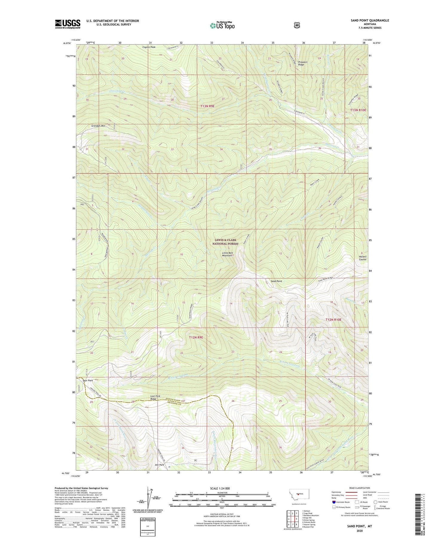
2020 topographic map quadrangle Sand Point in the state of Montana. Scale: 1:24000. Based on the newly updated USGS 7.5' US Topo map series, this map is in the following counties: Judith Basin, Meagher. The map contains contour data, water features, and other items you are used to seeing on USGS maps, but also has updated roads and other features. This is the next generation of topographic maps. Printed on high-quality waterproof paper with UV fade-resistant inks.
Quads adjacent to this one:
West: Kings Hill
Northwest: Neihart
North: Yogo Peak
Northeast: Bandbox Mountain
East: Ettien Spring
Southeast: Russian Flat
South: Hoover Spring
Southwest: Volcano Butte
Contains the following named places: Ant Park, Cleveland Creek, Collins Creek, Doerr Creek, Grendah Mountain, Harrison Creek, King Creek, Lenny Mine, Lost Fork Ridge, Middle Fork Ranch, Our Only Chance Mine, Sand Point, SE SE Section 21 Mine, Spur Park, Stiner Creek, SW SE Section 29 Mine, Warm Springs Creek, Weatherwax Creek


