MyTopo
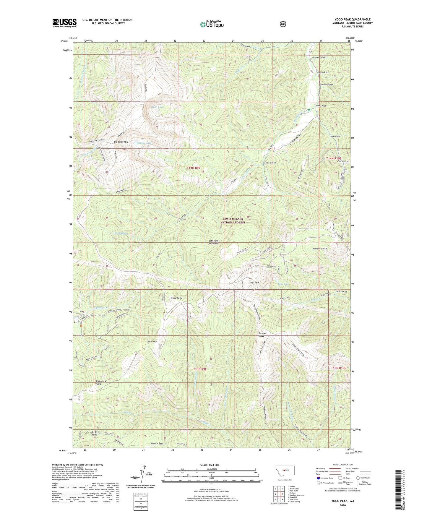
Yogo Peak Montana US Topo Map
Couldn't load pickup availability
Also explore the Yogo Peak Forest Service Topo of this same quad for updated USFS data
2024 topographic map quadrangle Yogo Peak in the state of Montana. Scale: 1:24000. Based on the newly updated USGS 7.5' US Topo map series, this map is in the following counties: Judith Basin. The map contains contour data, water features, and other items you are used to seeing on USGS maps, but also has updated roads and other features. This is the next generation of topographic maps. Printed on high-quality waterproof paper with UV fade-resistant inks.
Quads adjacent to this one:
West: Neihart
Northwest: Barker
North: Mixes Baldy
Northeast: Wolf Butte
East: Bandbox Mountain
Southeast: Ettien Spring
South: Sand Point
Southwest: Kings Hill
This map covers the same area as the classic USGS quad with code o46110h5.
Contains the following named places: Appraisal Creek, Big Baldy Mountain, Big Deer Point, Cabin Mountain, Coyote Peak, Dry Wolf Campground, East Fork Stiner Creek, Flat Gulch, Gravel Gulch, Hell Creek, Iron Gulch, Lake Elva, Lead Gulch, Lyons Gulch, NE SE Section 36 Mine, NW NE Section 2 Mine, NW NE Section 31 Mine, NW SE Section 10 Mine, Prospect Ridge, Rhoda Lake, Rolfe Gulch, SE SW Section 31 Mine, Silver Gulch, Slide Rock Point, Snow Creek, SW SW Section 3 Mine, Tepee Butte, Tucken Gulch, Twin Lakes, West Fork Stiner Creek, Yogo Peak