MyTopo
Hoover Spring Montana US Topo Map
Couldn't load pickup availability
Also explore the Hoover Spring Forest Service Topo of this same quad for updated USFS data
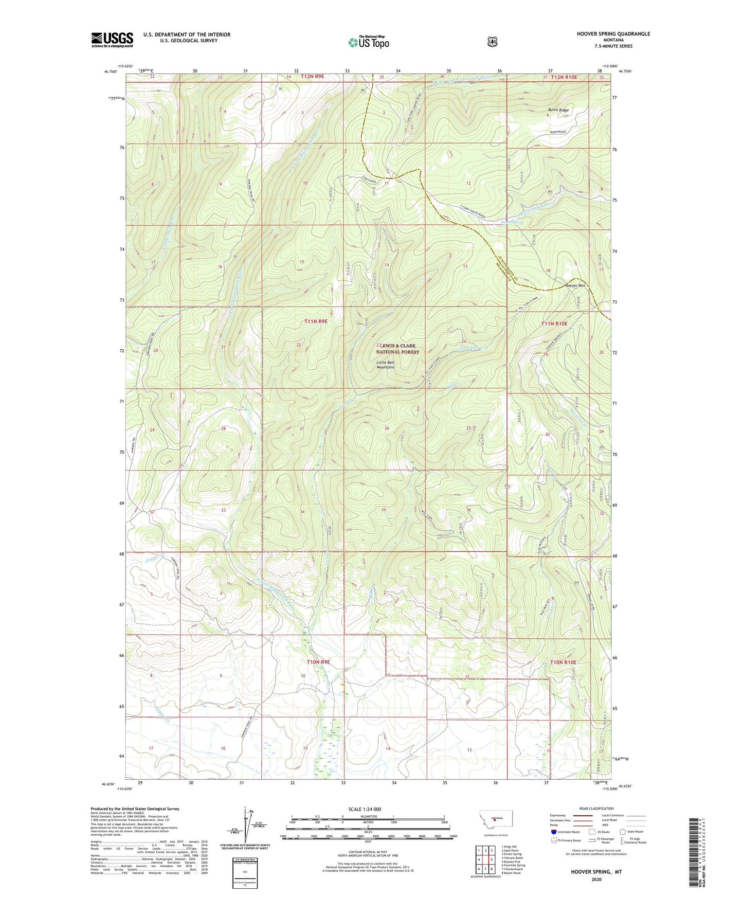
2024 topographic map quadrangle Hoover Spring in the state of Montana. Scale: 1:24000. Based on the newly updated USGS 7.5' US Topo map series, this map is in the following counties: Meagher, Judith Basin. The map contains contour data, water features, and other items you are used to seeing on USGS maps, but also has updated roads and other features. This is the next generation of topographic maps. Printed on high-quality waterproof paper with UV fade-resistant inks.
Quads adjacent to this one:
West: Volcano Butte
Northwest: Kings Hill
North: Sand Point
Northeast: Ettien Spring
East: Russian Flat
Southeast: Mount Howe
South: Checkerboard
Southwest: Fourmile Spring
This map covers the same area as the classic USGS quad with code o46110f5.
Contains the following named places: Brock Ranch, Burnt Ridge, East Fork Lion Creek, Hoover Mountain, Hoover Spring, Hunters Camp, Lion Creek, Lion Creek Campground, Mill Creek