MyTopo
Savage Montana US Topo Map
Couldn't load pickup availability
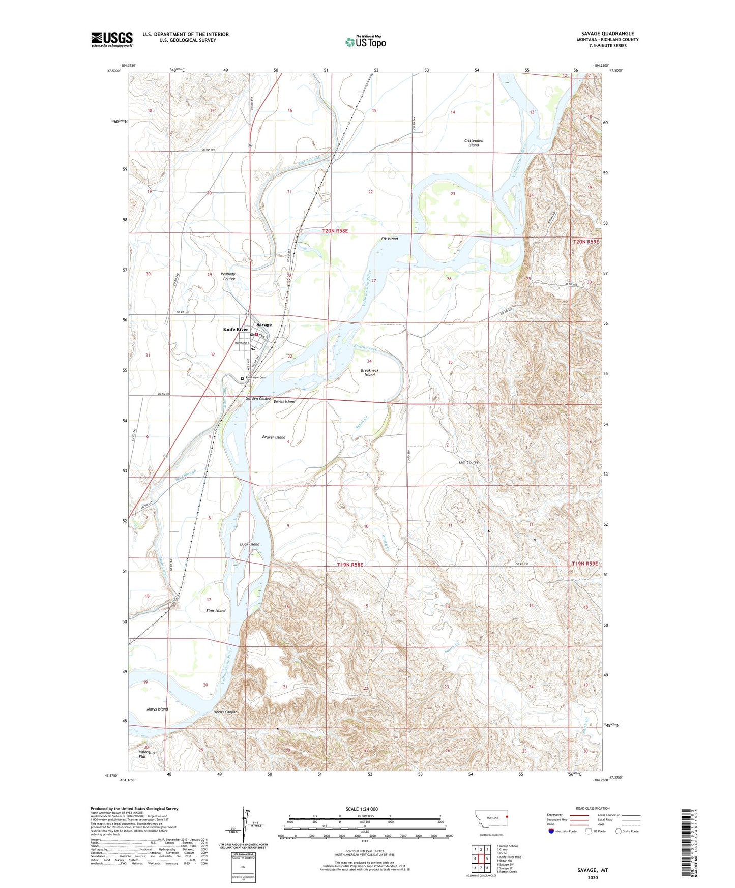
2020 topographic map quadrangle Savage in the state of Montana. Scale: 1:24000. Based on the newly updated USGS 7.5' US Topo map series, this map is in the following counties: Richland. The map contains contour data, water features, and other items you are used to seeing on USGS maps, but also has updated roads and other features. This is the next generation of topographic maps. Printed on high-quality waterproof paper with UV fade-resistant inks.
Quads adjacent to this one:
West: Knife River Mine
Northwest: Larson School
North: Crane
Northeast: Piche
East: Skaar NW
Southeast: Parson Creek
South: Savage SE
Southwest: Savage SW
Contains the following named places: 19N58E02DBBB01 Well, 19N58E04DDC_01 Well, 19N58E04DDCA01 Well, 19N58E05BA__01 Well, 19N58E05CD__01 Well, 19N58E07AADA01 Well, 19N58E08AD__01 Well, 19N58E08BC__01 Well, 19N58E18AD__01 Well, 19N58E18DB__01 Well, 19N58E18DC__01 Well, 20N58E14AA__01 Well, 20N58E14BB__01 Well, 20N58E15AD__01 Well, 20N58E15CD__01 Well, 20N58E15CD__02 Well, 20N58E16BA__01 Well, 20N58E16BB__01 Well, 20N58E16BC__01 Well, 20N58E16BD__01 Well, 20N58E17DD__01 Well, 20N58E18DD__01 Well, 20N58E19AD__01 Well, 20N58E20AA__01 Well, 20N58E20AB__01 Well, 20N58E20CA__01 Well, 20N58E20DD__01 Well, 20N58E21AD__01 Well, 20N58E21BB__01 Well, 20N58E22DA__01 Well, 20N58E24ABAA01 Well, 20N58E25CCAC01 Well, 20N58E28BA__01 Well, 20N58E28BD__01 Well, 20N58E29AA__01 Well, 20N58E29CBC_01 Well, 20N58E29CD__01 Well, 20N58E29DB__01 Well, 20N58E29DC__01 Well, 20N58E29DD__01 Well, 20N58E30DB__01 Well, 20N58E32AA__01 Well, 20N58E32AC__01 Well, 20N58E32AC__02 Well, 20N58E32AD__01 Well, 20N58E32BB__02 Well, 20N58E32DD__01 Well, 20N58E33BA__01 Well, 20N58E33BA__02 Well, 20N58E33BA__03 Well, 20N58E33BB__01 Well, 20N58E33BC__01 Well, 20N58E33CB__01 Well, 20N58E34DDD_01 Well, 20N58E35BC__01 Well, 21N58E08DDAD01 Well, Beaver Island, Beef Slough, Brasseaus Houses, Breakneck Island, Cecil Junction, Crittenden Island, Devils Canyon, Devils Island, Duck Island, Dundee Post Office, Dunlap Creek, Elk Island, Elk Island Fishing Access Site, Elm Coulee, Elm Coulee School, Elms Island, First Congregational Church, First Lutheran Church of Savage, Garden Coulee, Knife River, Marys Island, Peabody Coulee, Richland County Ambulance Savage, Riverview Cemetery, Saint Michaels Catholic Church, Savage, Savage Census Designated Place, Savage Museum, Savage Post Office, Savage Public School, Savage Volunteer Fire Company, Smith Creek, Tokna Post Office, Yellowstone Community Church