MyTopo
Knife River Mine Montana US Topo Map
Couldn't load pickup availability
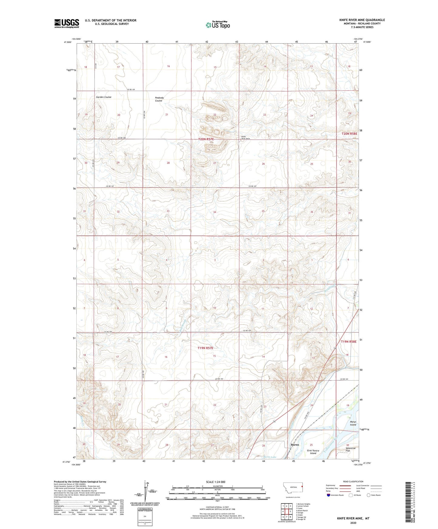
2024 topographic map quadrangle Knife River Mine in the state of Montana. Scale: 1:24000. Based on the newly updated USGS 7.5' US Topo map series, this map is in the following counties: Richland. The map contains contour data, water features, and other items you are used to seeing on USGS maps, but also has updated roads and other features. This is the next generation of topographic maps. Printed on high-quality waterproof paper with UV fade-resistant inks.
Quads adjacent to this one:
West: Allard Ranch
Northwest: McCone Heights
North: Larson School
Northeast: Crane
East: Savage
Southeast: Savage SE
South: Savage SW
Southwest: Intake
This map covers the same area as the classic USGS quad with code o47104d4.
Contains the following named places: 19N57E08ACCC01 Well, 19N57E13AB__01 Well, 19N57E14BD__01 Well, 19N57E21BABB01 Well, 19N57E24AC__01 Well, 19N57E25BB__01 Well, 19N57E26AD__01 Well, 19N58E06BA__01 Well, 19N58E07BD__01 Well, 19N58E07BD__02 Well, 19N58E18BA__01 Well, 19N58E18CC__01 Well, 19N58E18CD__01 Well, 20N57E13BD__01 Well, 20N57E16CDDD01 Well, 20N57E21CDDA01 Well, 20N57E22DD__01 Well, 20N57E27DC__01 Well, 20N57E27DCDC01 Well, 20N57E30DDAB01 Well, 59262, Burns, Burns Post Office, Burns School, Gros Ventre Island, Knife River Mine