MyTopo
Savage SW Montana US Topo Map
Couldn't load pickup availability
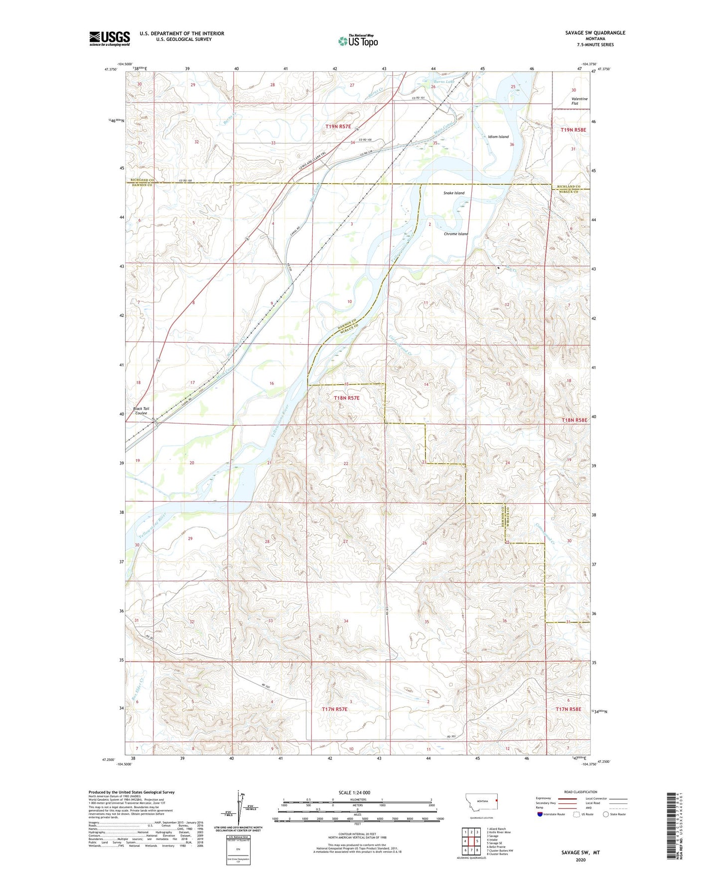
2024 topographic map quadrangle Savage SW in the state of Montana. Scale: 1:24000. Based on the newly updated USGS 7.5' US Topo map series, this map is in the following counties: Dawson, Wibaux, Richland. The map contains contour data, water features, and other items you are used to seeing on USGS maps, but also has updated roads and other features. This is the next generation of topographic maps. Printed on high-quality waterproof paper with UV fade-resistant inks.
Quads adjacent to this one:
West: Intake
Northwest: Allard Ranch
North: Knife River Mine
Northeast: Savage
East: Savage SE
Southeast: Cluster Buttes
South: Cluster Buttes NW
Southwest: Belle Prairie
This map covers the same area as the classic USGS quad with code o47104c4.
Contains the following named places: 17N57E02DC__01 Well, 18N57E03AB__01 Well, 18N57E03ABAB01 Well, 18N57E04AA__01 Well, 18N57E04CD__01 Well, 18N57E04DD__01 Well, 18N57E06ADDA01 Well, 18N57E09DBAB01 Well, 18N57E10BB__01 Well, 18N57E11DACB01 Well, 18N57E15ADCC01 Well, 18N57E17BD__01 Well, 18N57E19AD__01 Well, 18N57E20BC__01 Well, 18N57E24DDAA01 Well, 18N57E29DDBD01 Well, 19N57E26DD__01 Well, 19N57E27DDAC01 Well, 19N57E34CC__01 Well, Black Tail Coulee, Burns Creek, Burns Lake, Chrome Island, Cottonwood Creek, Dry Creek, Idiom Island, Loughboro School, Lufboro, Marco, Marco Post Office, Snake Island, War Dance Creek, Washington School