MyTopo
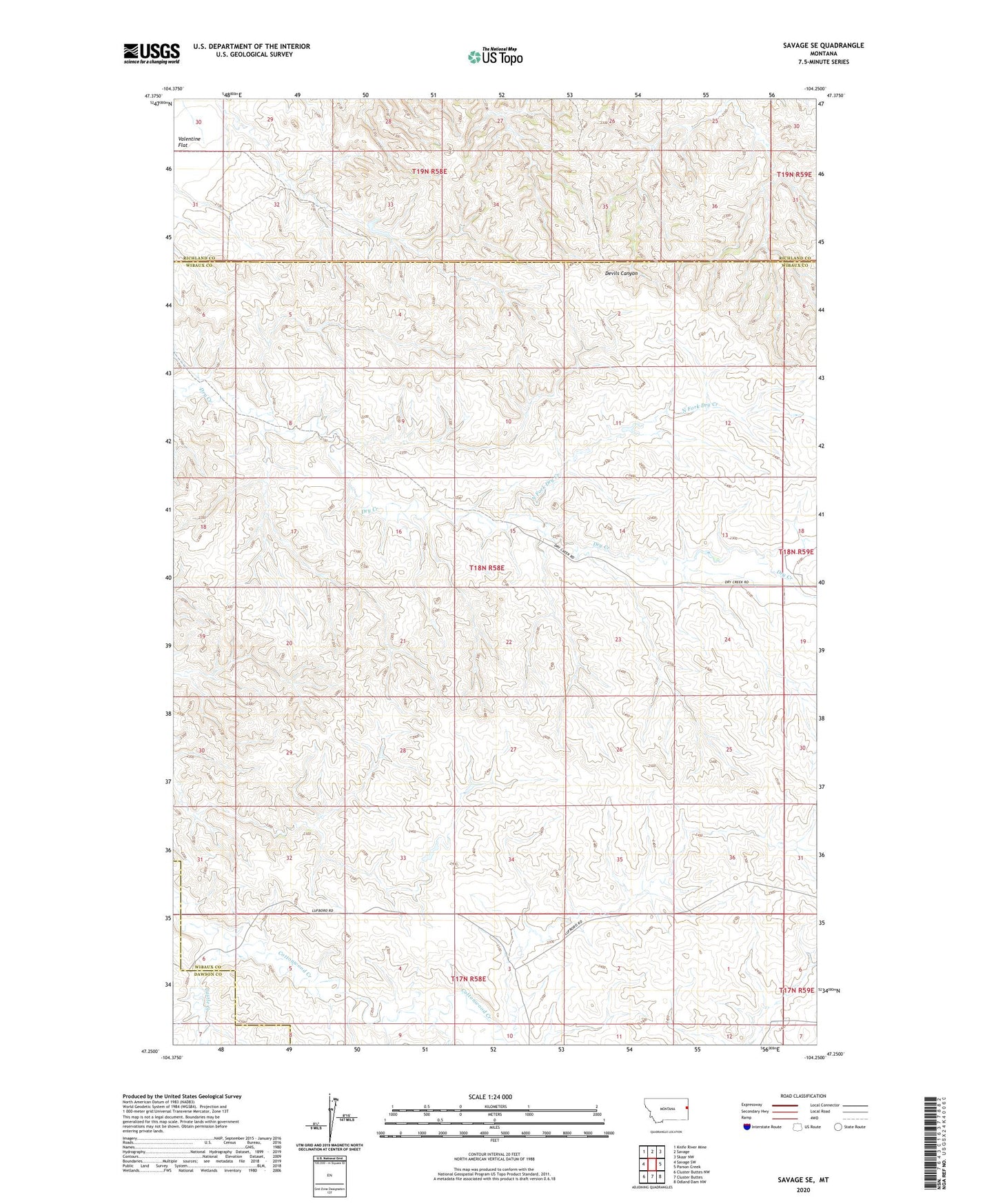
Savage SE Montana US Topo Map
Couldn't load pickup availability
2024 topographic map quadrangle Savage SE in the state of Montana. Scale: 1:24000. Based on the newly updated USGS 7.5' US Topo map series, this map is in the following counties: Wibaux, Richland, Dawson. The map contains contour data, water features, and other items you are used to seeing on USGS maps, but also has updated roads and other features. This is the next generation of topographic maps. Printed on high-quality waterproof paper with UV fade-resistant inks.
Quads adjacent to this one:
West: Savage SW
Northwest: Knife River Mine
North: Savage
Northeast: Skaar NW
East: Parson Creek
Southeast: Odland Dam NW
South: Cluster Buttes
Southwest: Cluster Buttes NW
This map covers the same area as the classic USGS quad with code o47104c3.
Contains the following named places: 17N58E09BABA01 Well, 18N58E01CCC_01 Well, 18N58E02DADD01 Well, 18N58E08DABA01 Well, 18N58E14CDBB01 Well, 18N58E15BDAC01 Well, 18N58E21CDDD01 Well, 18N58E27BAAD01 Well, 18N58E32BADD01 Well, 18N58E34DCCD01 Well, Castle Creek, Dry Creek School, Farm Service Agency Interest of Montana, North Fork Dry Creek, Smith Creek Grazing District Dam, Temple Dam, Valentine Flat