MyTopo
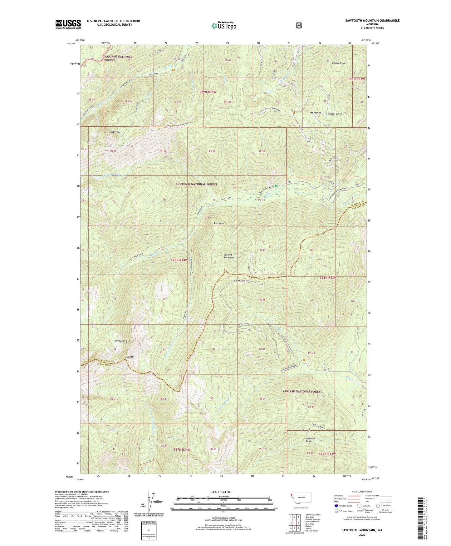
Sawtooth Mountain Montana US Topo Map
Couldn't load pickup availability
Also explore the Sawtooth Mountain Forest Service Topo of this same quad for updated USFS data
2024 topographic map quadrangle Sawtooth Mountain in the state of Montana. Scale: 1:24000. Based on the newly updated USGS 7.5' US Topo map series, this map is in the following counties: Lincoln, Sanders. The map contains contour data, water features, and other items you are used to seeing on USGS maps, but also has updated roads and other features. This is the next generation of topographic maps. Printed on high-quality waterproof paper with UV fade-resistant inks.
Quads adjacent to this one:
West: Scotchman Peak
Northwest: Benning Mountain
North: Spar Lake
Northeast: Crowell Mountain
East: Ibex Peak
Southeast: Smeads Bench
South: Heron
Southwest: Cabinet
This map covers the same area as the classic USGS quad with code o48115b8.
Contains the following named places: Asarco Incorporated, Cub Creek, Middle Mountain, Mount Vernon, North Fork Ross Creek, Pooch Creek, Ross Creek Campground, Ross Creek Falls and Vista, Ross Creek Natural Area, Ross Creek Pack Trail, Ross Creek Picnic Area, Ross Point, Sawtooth Mountain, South Fork Dry Creek, South Fork Ross Creek, South Fork Ross Creek Trail, Spar Peak, Stanley Creek Mine