MyTopo
Smeads Bench Montana US Topo Map
Couldn't load pickup availability
Also explore the Smeads Bench Forest Service Topo of this same quad for updated USFS data
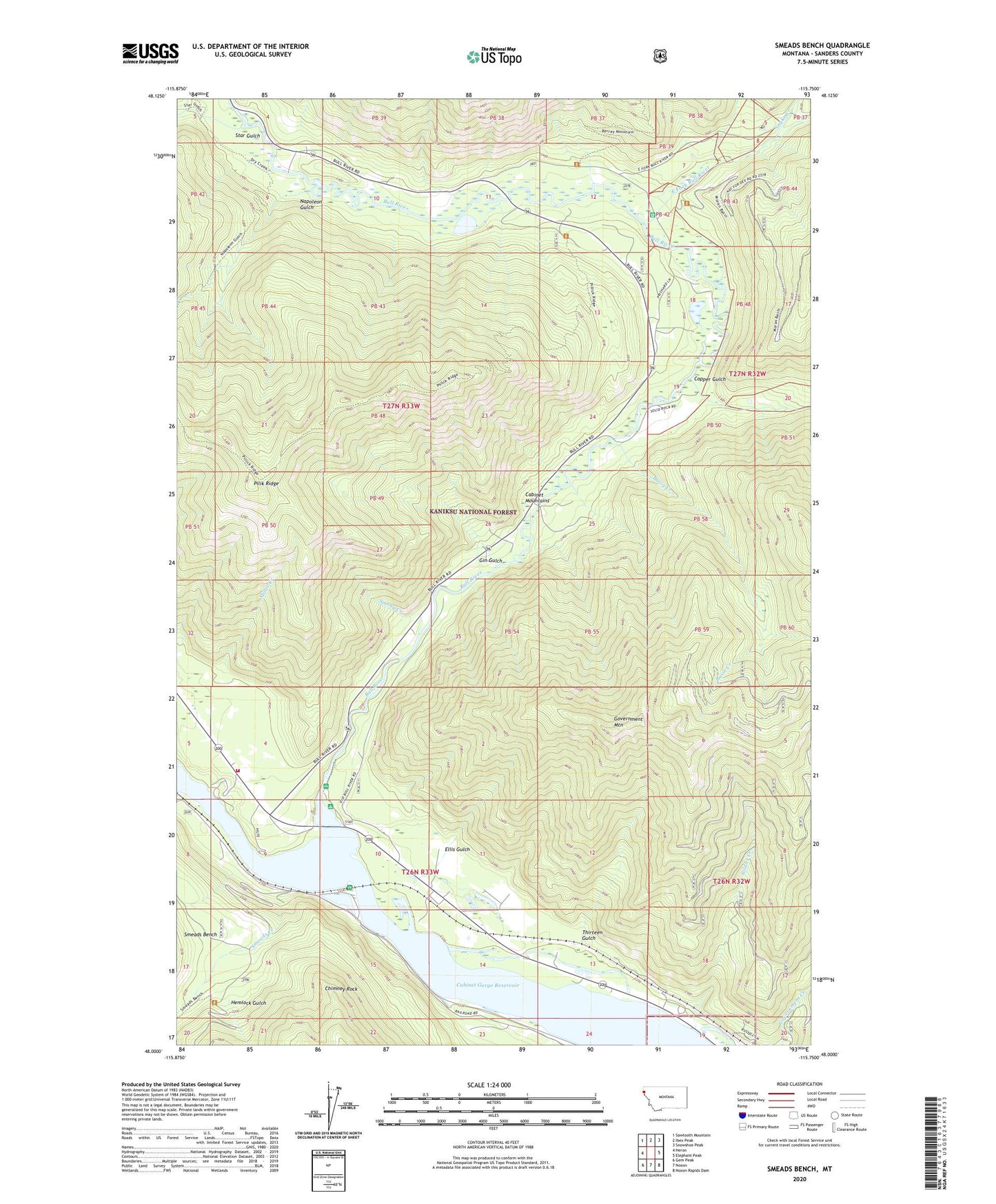
2024 topographic map quadrangle Smeads Bench in the state of Montana. Scale: 1:24000. Based on the newly updated USGS 7.5' US Topo map series, this map is in the following counties: Sanders. The map contains contour data, water features, and other items you are used to seeing on USGS maps, but also has updated roads and other features. This is the next generation of topographic maps. Printed on high-quality waterproof paper with UV fade-resistant inks.
Quads adjacent to this one:
West: Heron
Northwest: Sawtooth Mountain
North: Ibex Peak
Northeast: Snowshoe Peak
East: Elephant Peak
Southeast: Noxon Rapids Dam
South: Noxon
Southwest: Gem Peak
This map covers the same area as the classic USGS quad with code o48115a7.
Contains the following named places: 26N33W03CACD01 Well, 26N33W04CBAB01 Well, 59853, Basin Creek, Bull River, Bull River Campground, Bull River Guard Station, Bull River Recreation Site, Cabinet Gorge RV and Recreation, Chimney Rock, Copper Gulch, East Fork Bull River, Ellis Gulch, Gin Gulch, Government Mountain, Hemlock Gulch, Hereford Restaurant Campground, Miller Creek, Moderie, Napoleon Gulch, Noxon Satellite Fire Department, Noxon Siding, Pilik Ridge, Smead, Smead Post Office, Smeads Bench, Smeads Creek, Smoky Creek, Snake Creek, Soldier Creek, Star Gulch, Thirteen Gulch