MyTopo
Schrammeck Lake Montana US Topo Map
Couldn't load pickup availability
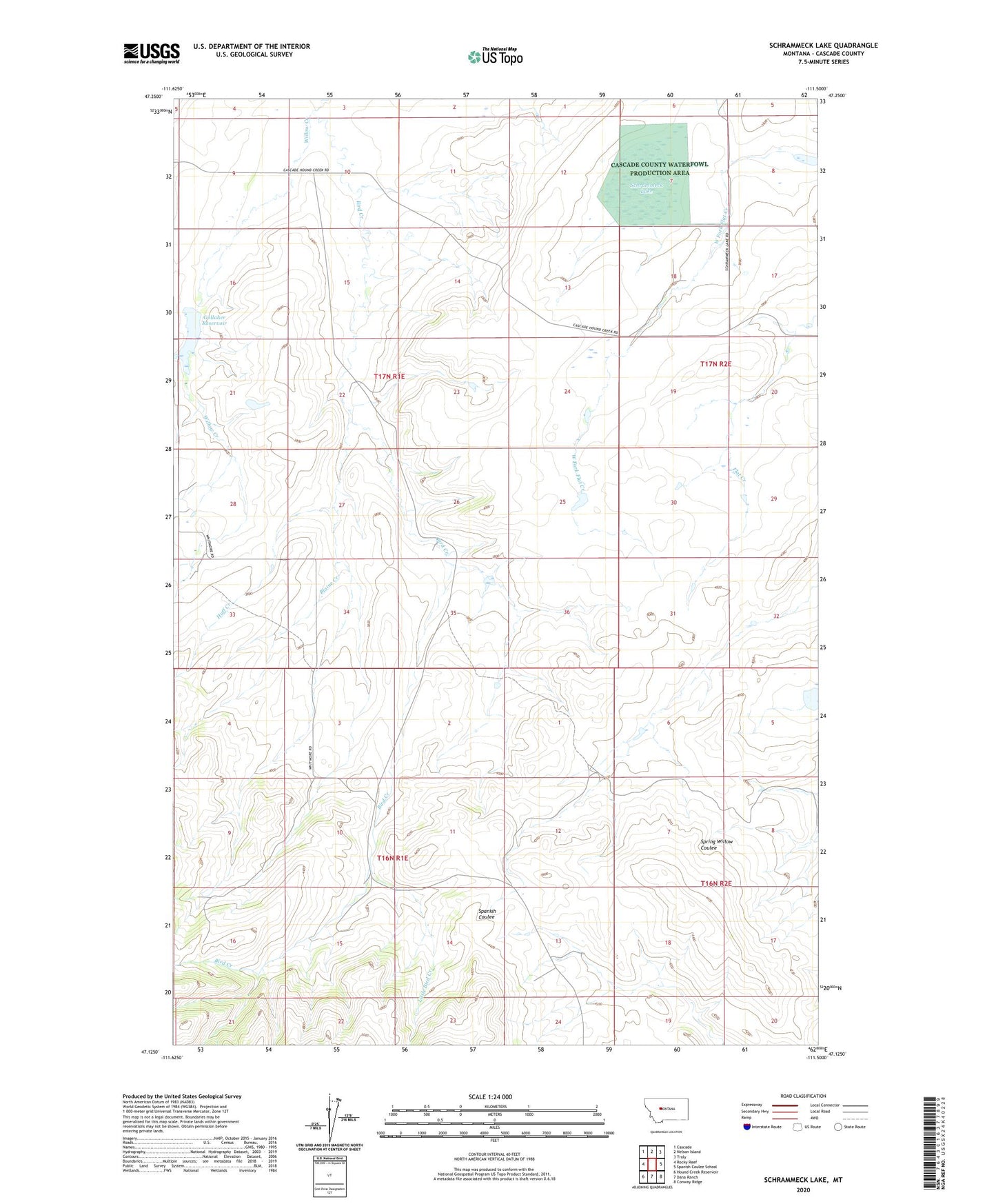
2020 topographic map quadrangle Schrammeck Lake in the state of Montana. Scale: 1:24000. Based on the newly updated USGS 7.5' US Topo map series, this map is in the following counties: Cascade. The map contains contour data, water features, and other items you are used to seeing on USGS maps, but also has updated roads and other features. This is the next generation of topographic maps. Printed on high-quality waterproof paper with UV fade-resistant inks.
Quads adjacent to this one:
West: Rocky Reef
Northwest: Cascade
North: Nelson Island
Northeast: Truly
East: Spanish Coulee School
Southeast: Conway Ridge
South: Dana Ranch
Southwest: Hound Creek Reservoir
Contains the following named places: 16N01E11C___01 Spring, 16N01E13A___01 Well, 16N01E13C___01 Spring, 16N01E15B___01 Spring, 16N02E08C___01 Spring, 17N01E09D___01 Well, 17N01E28C___01 Spring, 17N01E33B___01 Well, 17N02E18D___01 Well, 17N02E18D___02 Well, 17N02E18D___03 Well, 17N02E19B___01 Well, Bird Creek School, Bird Post Office, Blaine Creek, Cascade County Waterfowl Production Area, Crum School, Gallaher Dam, Gollaher Reservoir, Huff Creek, Little Bird Creek, Schrammeck Lake, Willow Creek