MyTopo
Rocky Reef Montana US Topo Map
Couldn't load pickup availability
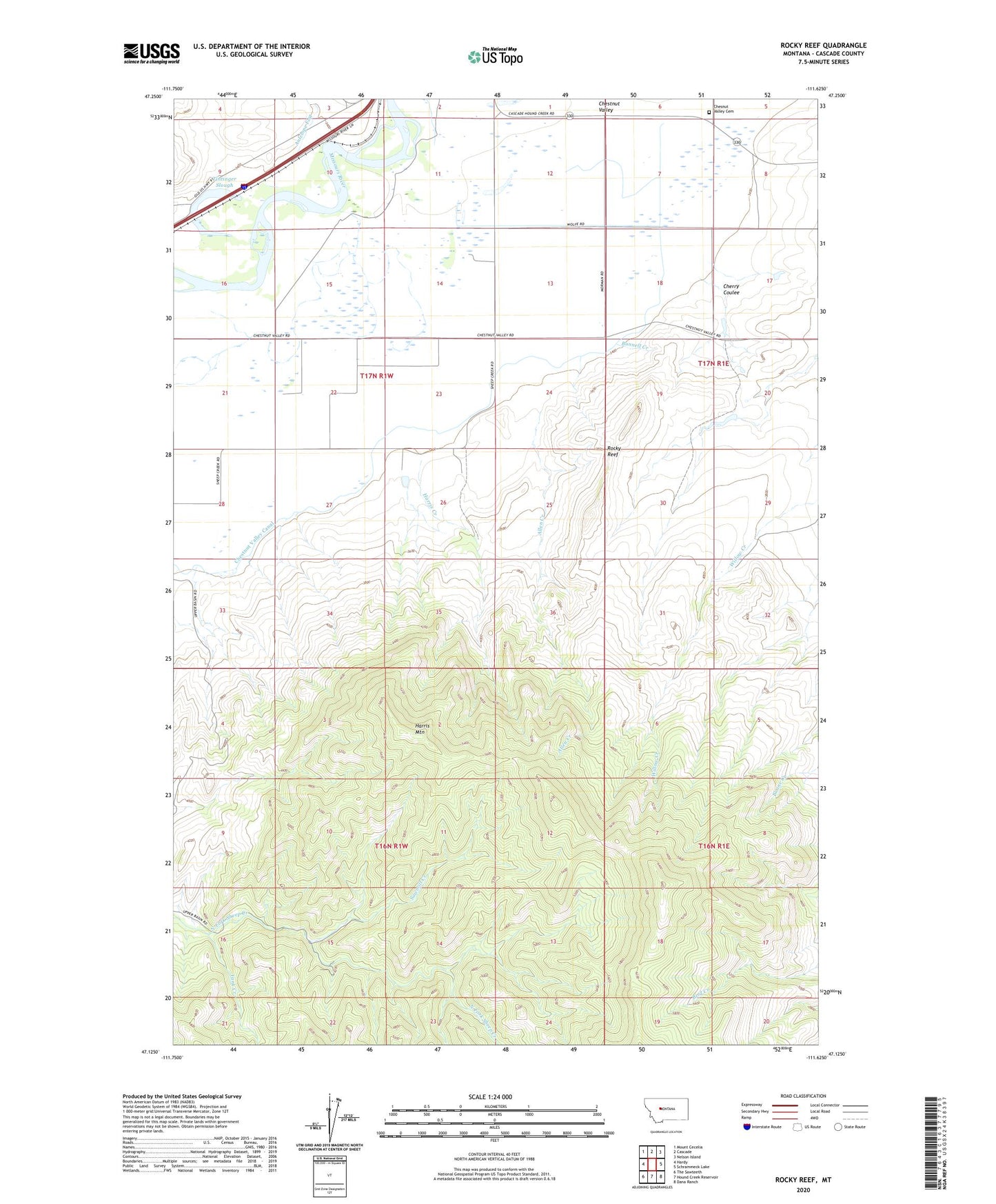
2024 topographic map quadrangle Rocky Reef in the state of Montana. Scale: 1:24000. Based on the newly updated USGS 7.5' US Topo map series, this map is in the following counties: Cascade. The map contains contour data, water features, and other items you are used to seeing on USGS maps, but also has updated roads and other features. This is the next generation of topographic maps. Printed on high-quality waterproof paper with UV fade-resistant inks.
Quads adjacent to this one:
West: Hardy
Northwest: Mount Cecelia
North: Cascade
Northeast: Nelson Island
East: Schrammeck Lake
Southeast: Dana Ranch
South: Hound Creek Reservoir
Southwest: The Sawteeth
This map covers the same area as the classic USGS quad with code o47111b6.
Contains the following named places: 17N01E08____01 Well, 17N01E08C___01 Well, 17N01E08D___01 Well, 17N01E29C___01 Spring, 17N01E29D___01 Well, 17N01E30D___01 Well, 17N01W13A___01 Well, 17N01W13B___01 Well, 17N01W14D___01 Spring, 17N01W25A___01 Spring, 17N01W26B___01 Spring, 17N01W27B___01 Well, Allen Creek, Barrett Field, Bunnell Creek, Cascade Division, Cherry Coulee, Chesnut Valley Cemetery, Chestnut Post Office, Chestnut Valley Canal, Chestnut Valley School, Dana-Cameron Ranch Dam, Harris Creek, Harris Mountain, Rocky Reef, Sawmill Creek, Tintinger Slough, Willow Creek School, Yank Creek