MyTopo
Hound Creek Reservoir Montana US Topo Map
Couldn't load pickup availability
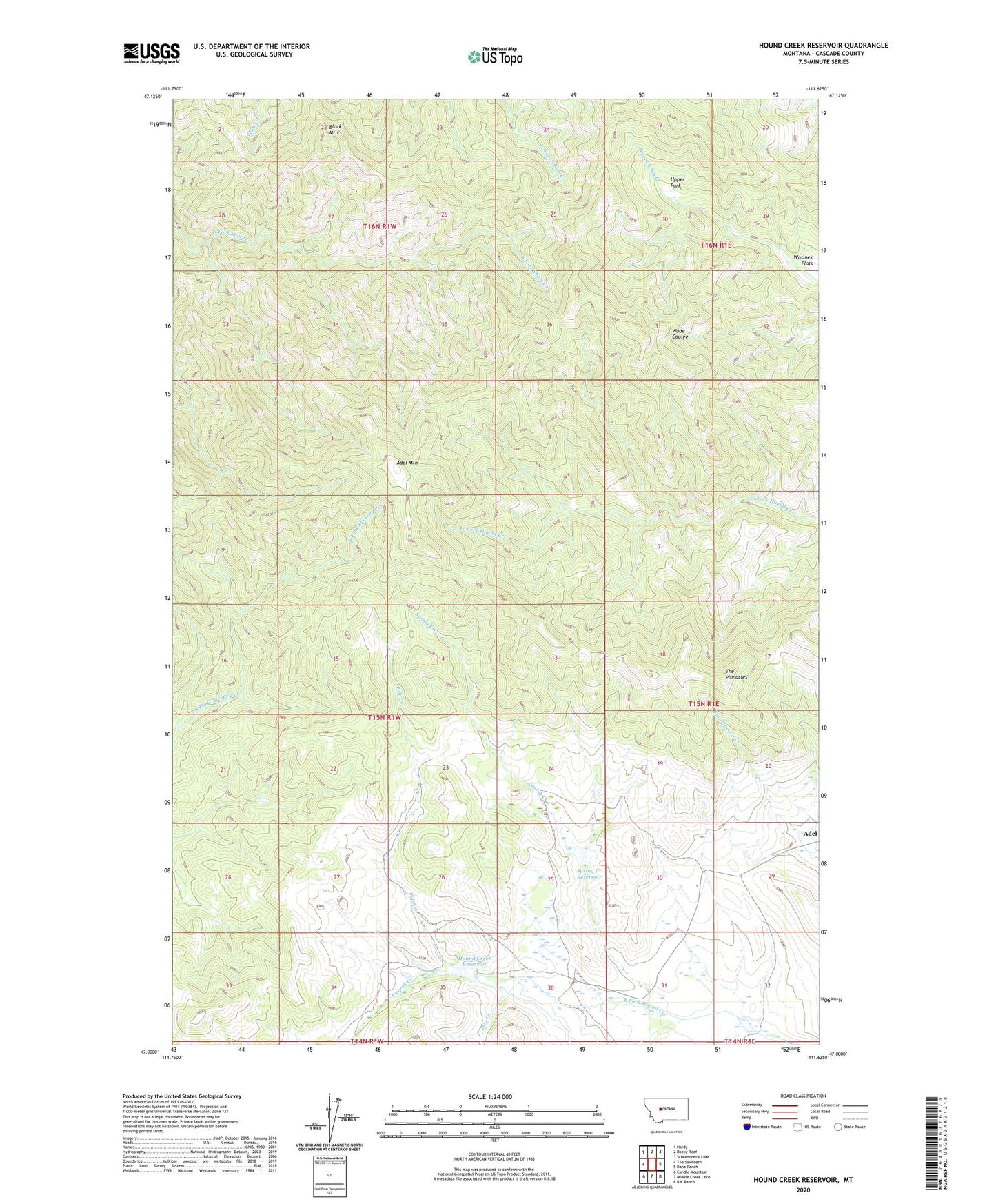
2024 topographic map quadrangle Hound Creek Reservoir in the state of Montana. Scale: 1:24000. Based on the newly updated USGS 7.5' US Topo map series, this map is in the following counties: Cascade. The map contains contour data, water features, and other items you are used to seeing on USGS maps, but also has updated roads and other features. This is the next generation of topographic maps. Printed on high-quality waterproof paper with UV fade-resistant inks.
Quads adjacent to this one:
West: The Sawteeth
Northwest: Hardy
North: Rocky Reef
Northeast: Schrammeck Lake
East: Dana Ranch
Southeast: B K Ranch
South: Middle Creek Lake
Southwest: Candle Mountain
This map covers the same area as the classic USGS quad with code o47111a6.
Contains the following named places: Adel Mountain, Black Mountain, Dog Creek, Hound Creek Dam, Hound Creek Reservoir, Pole Creek, Sieben Ranch, Spring Creek, Spring Creek Lake Dam, Spring Creek Reservoir, The Pinnacles, Tyrell Creek, Upper Park, ZIP Code: 59421