MyTopo
Williamson Butte Montana US Topo Map
Couldn't load pickup availability
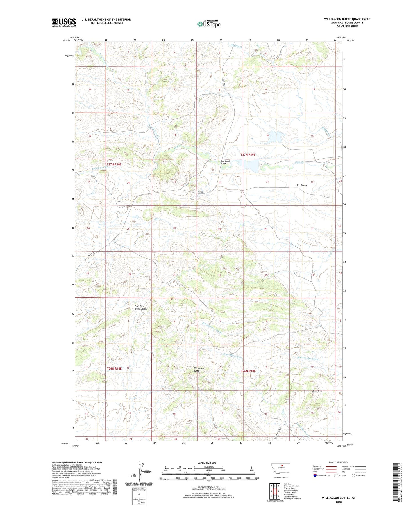
2024 topographic map quadrangle Williamson Butte in the state of Montana. Scale: 1:24000. Based on the newly updated USGS 7.5' US Topo map series, this map is in the following counties: Blaine. The map contains contour data, water features, and other items you are used to seeing on USGS maps, but also has updated roads and other features. This is the next generation of topographic maps. Printed on high-quality waterproof paper with UV fade-resistant inks.
Quads adjacent to this one:
West: Blue Stone Peak
Northwest: Maddux
North: Corrigan Mountain
Northeast: Scotty Butte
East: Runyan Bench
Southeast: Sandpiper Reservoir
South: Nolan Reservoir
Southwest: Saddle Rock
This map covers the same area as the classic USGS quad with code o48109a3.
Contains the following named places: Cow Creek Bridge, Cow Island Trail School, Goat Mountain, Golden Valley School, I U Reservoir Dam, North Fork Cow Creek, South Fork Cow Creek, T U Bench, T U Ranch, T U Reservoir, T U School, Williamson Butte