MyTopo
Sheep Coulee Montana US Topo Map
Couldn't load pickup availability
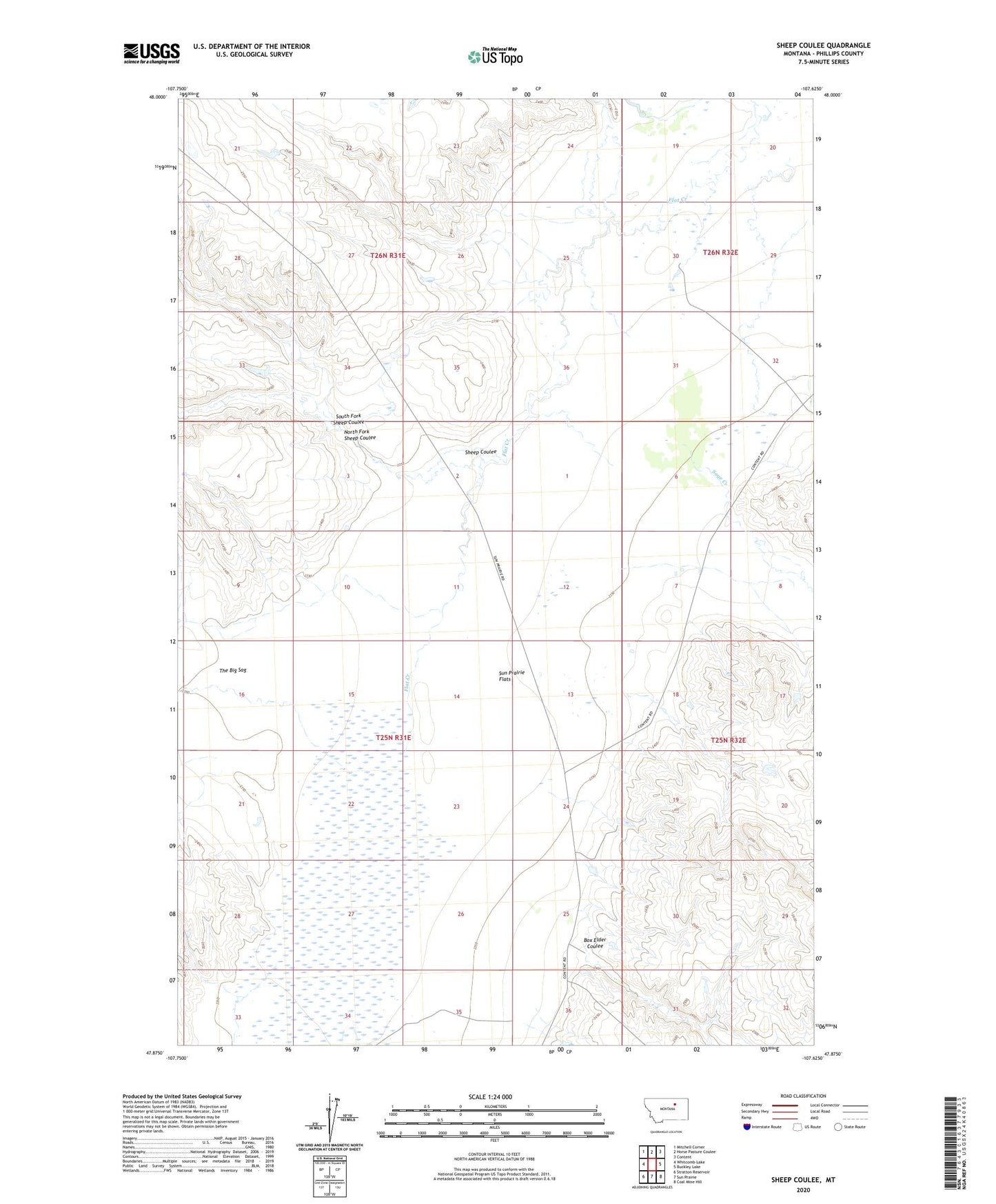
2020 topographic map quadrangle Sheep Coulee in the state of Montana. Scale: 1:24000. Based on the newly updated USGS 7.5' US Topo map series, this map is in the following counties: Phillips. The map contains contour data, water features, and other items you are used to seeing on USGS maps, but also has updated roads and other features. This is the next generation of topographic maps. Printed on high-quality waterproof paper with UV fade-resistant inks.
Quads adjacent to this one:
West: Whitcomb Lake
Northwest: Mitchell Corner
North: Horse Pasture Coulee
Northeast: Content
East: Buckley Lake
Southeast: Coal Mine Hill
South: Sun Prairie
Southwest: Stratton Reservoir
Contains the following named places: 25N31E25DB__01 Well, 25N31E36BA__01 Well, 26N32E30CA__01 Well, Box Elder, Box Elder Coulee, Box Elder School, Kelso Number 3 Dam, North Fork Sheep Coulee, Sage Creek, Sheep Coulee, South Fork Sheep Coulee, Sun Prairie Flats