MyTopo
Whitcomb Lake Montana US Topo Map
Couldn't load pickup availability
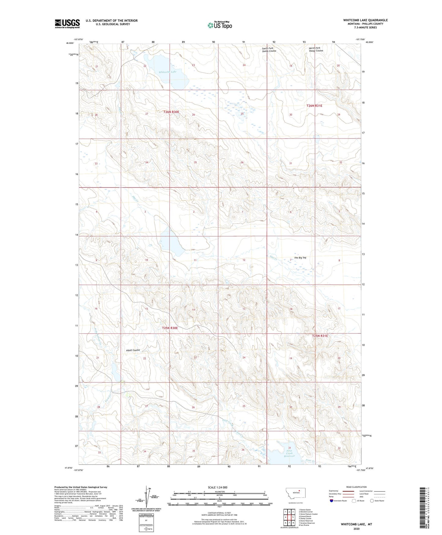
2024 topographic map quadrangle Whitcomb Lake in the state of Montana. Scale: 1:24000. Based on the newly updated USGS 7.5' US Topo map series, this map is in the following counties: Phillips. The map contains contour data, water features, and other items you are used to seeing on USGS maps, but also has updated roads and other features. This is the next generation of topographic maps. Printed on high-quality waterproof paper with UV fade-resistant inks.
Quads adjacent to this one:
West: Emond Ranch
Northwest: Button Butte
North: Mitchell Corner
Northeast: Horse Pasture Coulee
East: Sheep Coulee
Southeast: Sun Prairie
South: Stratton Reservoir
Southwest: Dione Reservoir
This map covers the same area as the classic USGS quad with code o47107h7.
Contains the following named places: 25N30E26CD__01 Well, 25N30E27BB__01 Well, Alkali Coulee, Blunt Ranches Number 4 Dam, Cotter Ranch, First Creek Reservoir, North Fork First Creek, The Big Sag, Veseth and Veseth Number 3 Dam, Whitcomb Lake