MyTopo
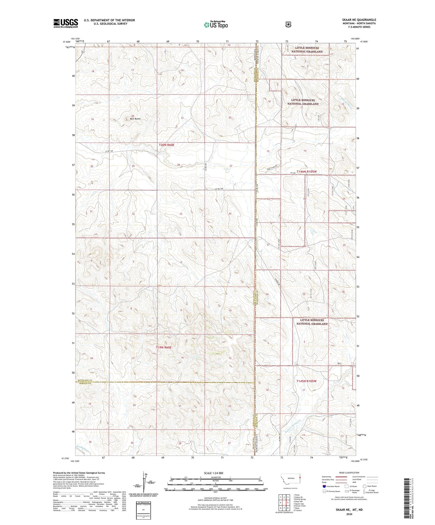
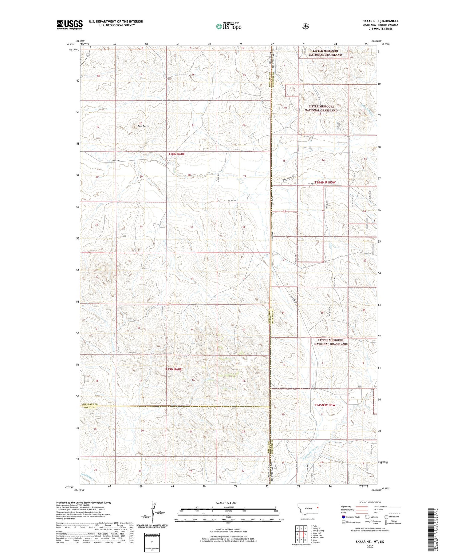
Skaar NE Montana US Topo Map
Couldn't load pickup availability
2020 topographic map quadrangle Skaar NE in the states of Montana, North Dakota. Scale: 1:24000. Based on the newly updated USGS 7.5' US Topo map series, this map is in the following counties: Richland, McKenzie, Wibaux. The map contains contour data, water features, and other items you are used to seeing on USGS maps, but also has updated roads and other features. This is the next generation of topographic maps. Printed on high-quality waterproof paper with UV fade-resistant inks.
Quads adjacent to this one:
West: Skaar NW
Northwest: Piche
North: Sidney SE
Northeast: Phillip Spring
East: Squaw Gap
Southeast: Trotters
South: Skaar
Southwest: Parson Creek
Contains the following named places: 19N60E17CD__01 Well, 19N60E27AC__01 Well, 19N60E28BA__01 Well, 20N60E17AD__01 Well, Bull Butte, Clark Post Office, Folkvord Ranch, Grace Lutheran Church, Kupper Ranch, Shadwell School, Thompson Headquarter Water Well, Thompson Ranch