MyTopo
South Sandstone Reservoir Montana US Topo Map
Couldn't load pickup availability
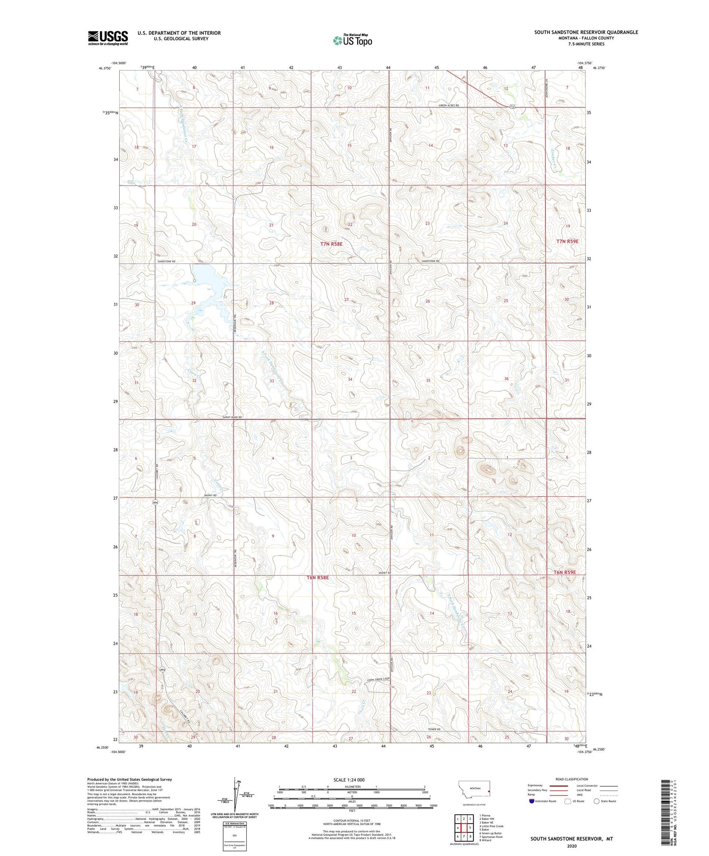
2024 topographic map quadrangle South Sandstone Reservoir in the state of Montana. Scale: 1:24000. Based on the newly updated USGS 7.5' US Topo map series, this map is in the following counties: Fallon. The map contains contour data, water features, and other items you are used to seeing on USGS maps, but also has updated roads and other features. This is the next generation of topographic maps. Printed on high-quality waterproof paper with UV fade-resistant inks.
Quads adjacent to this one:
West: Little Pine Creek
Northwest: Plevna
North: Baker NW
Northeast: Baker NE
East: Baker
Southeast: Willard
South: Sportsman Pond
Southwest: Seven-up Butte
This map covers the same area as the classic USGS quad with code o46104c4.
Contains the following named places: 06N58E04BB__01 Well, 06N58E04BD__01 Well, 06N58E05BA__01 Well, 06N58E06AC__01 Well, 06N58E10DC__01 Well, 06N58E14ABCD01 Well, 06N58E15CC__01 Well, 06N58E24BDAC01 Well, 06N58E25AA__01 Well, 06N58E25AA__02 Well, 07N58E13AB__01 Well, 07N58E13AC__01 Well, 07N58E18DD__01 Well, 07N58E32AA__01 Well, 07N58E32AA__02 Well, 07N58E33DC__01 Well, 07N59E24DCBB01 Well, 07N59E31BC__01 Well, Coon Creek, Ehret Number 1 Dam, Fallon County, R Maier Dam, South Sandstone Creek Dam, South Sandstone Fishing Access Site, South Sandstone Reservoir