MyTopo
Sportsman Pond Montana US Topo Map
Couldn't load pickup availability
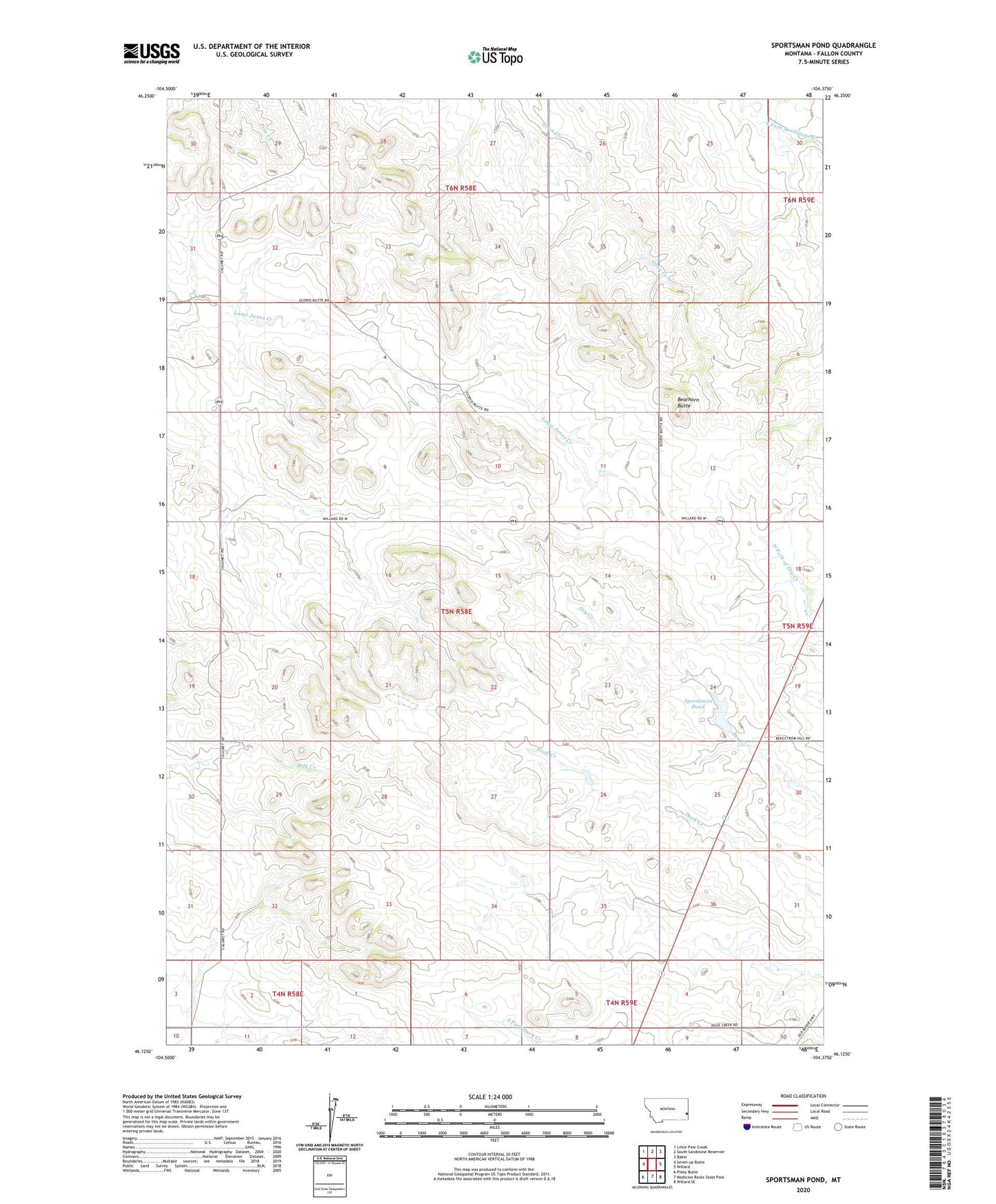
2024 topographic map quadrangle Sportsman Pond in the state of Montana. Scale: 1:24000. Based on the newly updated USGS 7.5' US Topo map series, this map is in the following counties: Fallon. The map contains contour data, water features, and other items you are used to seeing on USGS maps, but also has updated roads and other features. This is the next generation of topographic maps. Printed on high-quality waterproof paper with UV fade-resistant inks.
Quads adjacent to this one:
West: Seven-up Butte
Northwest: Little Pine Creek
North: South Sandstone Reservoir
Northeast: Baker
East: Willard
Southeast: Willard SE
South: Medicine Rocks State Park
Southwest: Piney Butte
This map covers the same area as the classic USGS quad with code o46104b4.
Contains the following named places: 04N59E05DACA01 Well, 05N58E04DB__01 Well, 05N58E10CBCC01 Well, 05N58E13DA__01 Well, 05N58E14BBBB01 Well, 05N58E16BDCD01 Well, 05N58E18AA__01 Well, 05N58E26DA__01 Well, 05N58E33BAAA01 Well, 05N58E35CA__01 Well, Bearhorn Butte, Boots Post Office, Red Hill School, Sportsman Dam, Sportsman Pond