MyTopo
Medicine Rocks State Park Montana US Topo Map
Couldn't load pickup availability
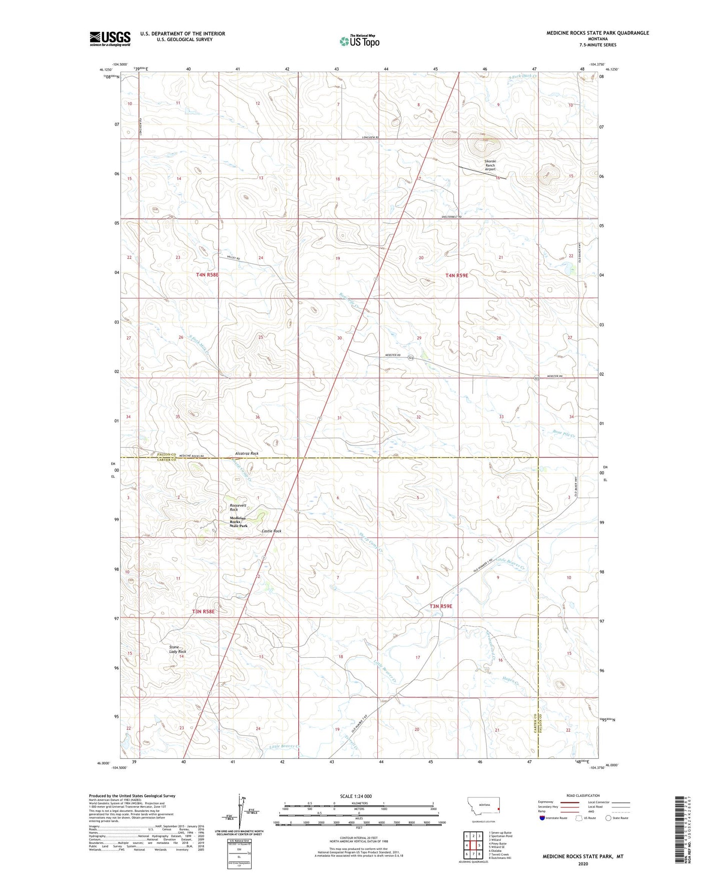
2024 topographic map quadrangle Medicine Rocks State Park in the state of Montana. Scale: 1:24000. Based on the newly updated USGS 7.5' US Topo map series, this map is in the following counties: Fallon, Carter. The map contains contour data, water features, and other items you are used to seeing on USGS maps, but also has updated roads and other features. This is the next generation of topographic maps. Printed on high-quality waterproof paper with UV fade-resistant inks.
Quads adjacent to this one:
West: Piney Butte
Northwest: Seven-up Butte
North: Sportsman Pond
Northeast: Willard
East: Willard SE
Southeast: Dutchmans Hill
South: Terrell Creek
Southwest: Ekalaka
This map covers the same area as the classic USGS quad with code o46104a4.
Contains the following named places: 03N58E05AAA_01 Well, 03N58E12BDCB01 Well, 03N59E20BCCB01 Well, 04N58E08BACD01 Well, 04N58E10DDAC01 Well, 04N58E30ADD_01 Well, 04N59E10DBBB01 Well, Alcatraz Rock, Castle Rock, Greasewood Creek, Hagen Creek, Medicine Rocks, Medicine Rocks Campground, Medicine Rocks Church, Medicine Rocks State Park, Red Root Post Office, Roosevelt Rock, Sheep Camp Creek, Sikorski Ranch Airport, Sikorsky and Sons Dam, Stone Lady Rock, Terrell Creek