MyTopo
Springtime Montana US Topo Map
Couldn't load pickup availability
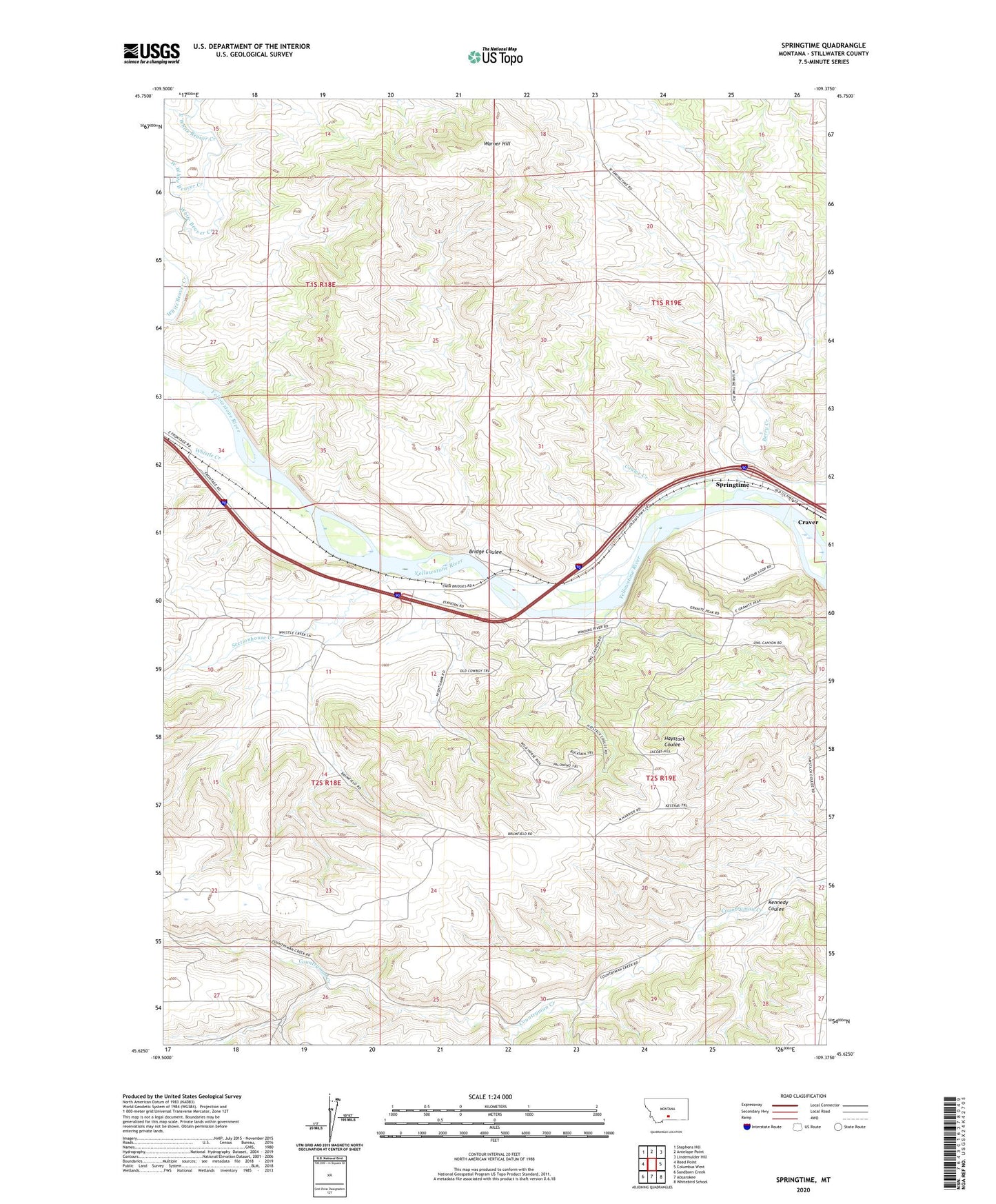
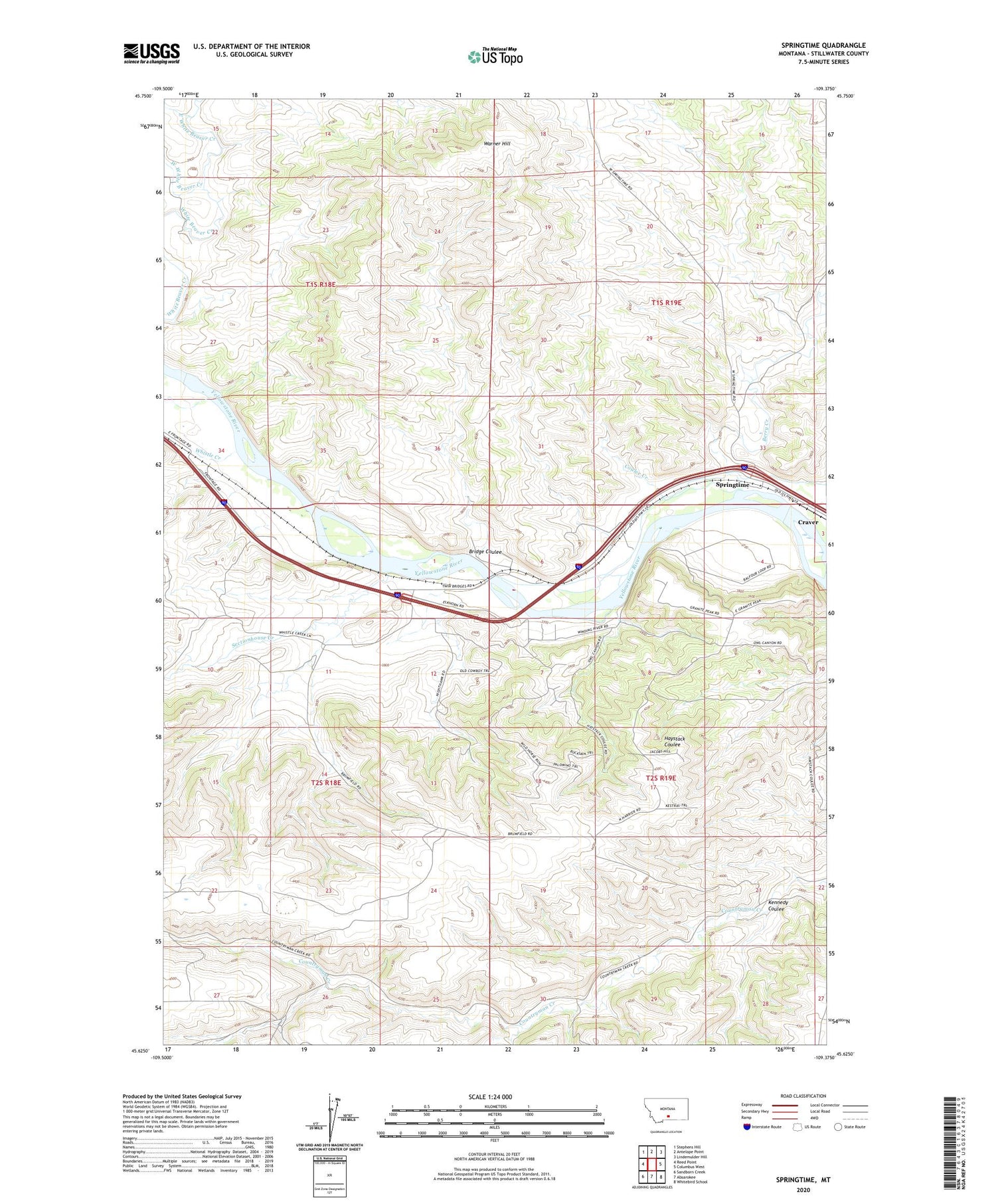
2020 topographic map quadrangle Springtime in the state of Montana. Scale: 1:24000. Based on the newly updated USGS 7.5' US Topo map series, this map is in the following counties: Stillwater. The map contains contour data, water features, and other items you are used to seeing on USGS maps, but also has updated roads and other features. This is the next generation of topographic maps. Printed on high-quality waterproof paper with UV fade-resistant inks.
Quads adjacent to this one:
West: Reed Point
Northwest: Stephens Hill
North: Antelope Point
Northeast: Lindemulder Hill
East: Columbus West
Southeast: Whitebird School
South: Absarokee
Southwest: Sandborn Creek
Contains the following named places: Berry Creek, Bridge Coulee, Coulee Creek, Countryman Creek School, Craver, East White Beaver Creek, Kennedy Coulee, Merrill Post Office, Oneida, Sectionhouse Creek, Springtime, Springtime Number 1 Dam, Springtime Post Office, Stillwater County, Warner Hill, West White Beaver Creek, Whistle Creek