MyTopo
Whitebird School Montana US Topo Map
Couldn't load pickup availability
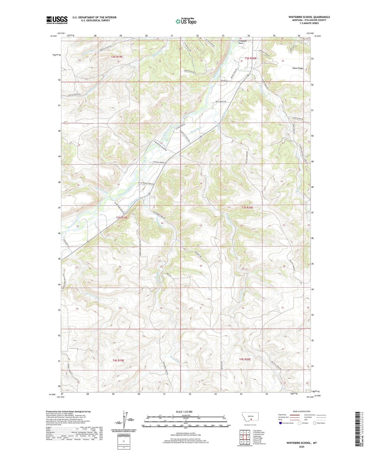
2024 topographic map quadrangle Whitebird School in the state of Montana. Scale: 1:24000. Based on the newly updated USGS 7.5' US Topo map series, this map is in the following counties: Stillwater. The map contains contour data, water features, and other items you are used to seeing on USGS maps, but also has updated roads and other features. This is the next generation of topographic maps. Printed on high-quality waterproof paper with UV fade-resistant inks.
Quads adjacent to this one:
West: Absarokee
Northwest: Springtime
North: Columbus West
Northeast: Columbus East
East: Shane Ridge
Southeast: Cooney Reservoir
South: Roscoe NE
Southwest: Roscoe NW
This map covers the same area as the classic USGS quad with code o45109e3.
Contains the following named places: 02S20E32ABAA01 Well, 02S20E32ADDC01 Well, 02S20E32DDBB01 Well, 03S19E13CACB01 Well, 03S19E13CBAC01 Well, 03S19E13CCAA01 Well, 03S19E13CCAA02 Well, 03S19E13CCAB01 Well, 03S19E13CCAD01 Well, 03S19E23ABCD01 Well, 03S19E23BABD01 Well, 03S20E05ABBB01 Well, 03S20E05ABBB02 Well, 03S20E05BAAA01 Well, 03S20E05BAAB01 Well, 03S20E07AADB01 Well, 04S19E03BCDA01 Well, Columbus Division, Firemans Point, Firemans Point Fishing Access Site, Halfway House, Joe Hill Creek, Mexican Joe Creek, Norve Coulee, Orson Coulee, Porter Coulee, Scott Ditch, Shane Creek, Shane Ditch, Swinging Bridge Fishing Access Site, Whitebird Creek, Whitebird Ditch, Whitebird Fishing Access Site, Whitebird School