MyTopo
Strawberry Butte Montana US Topo Map
Couldn't load pickup availability
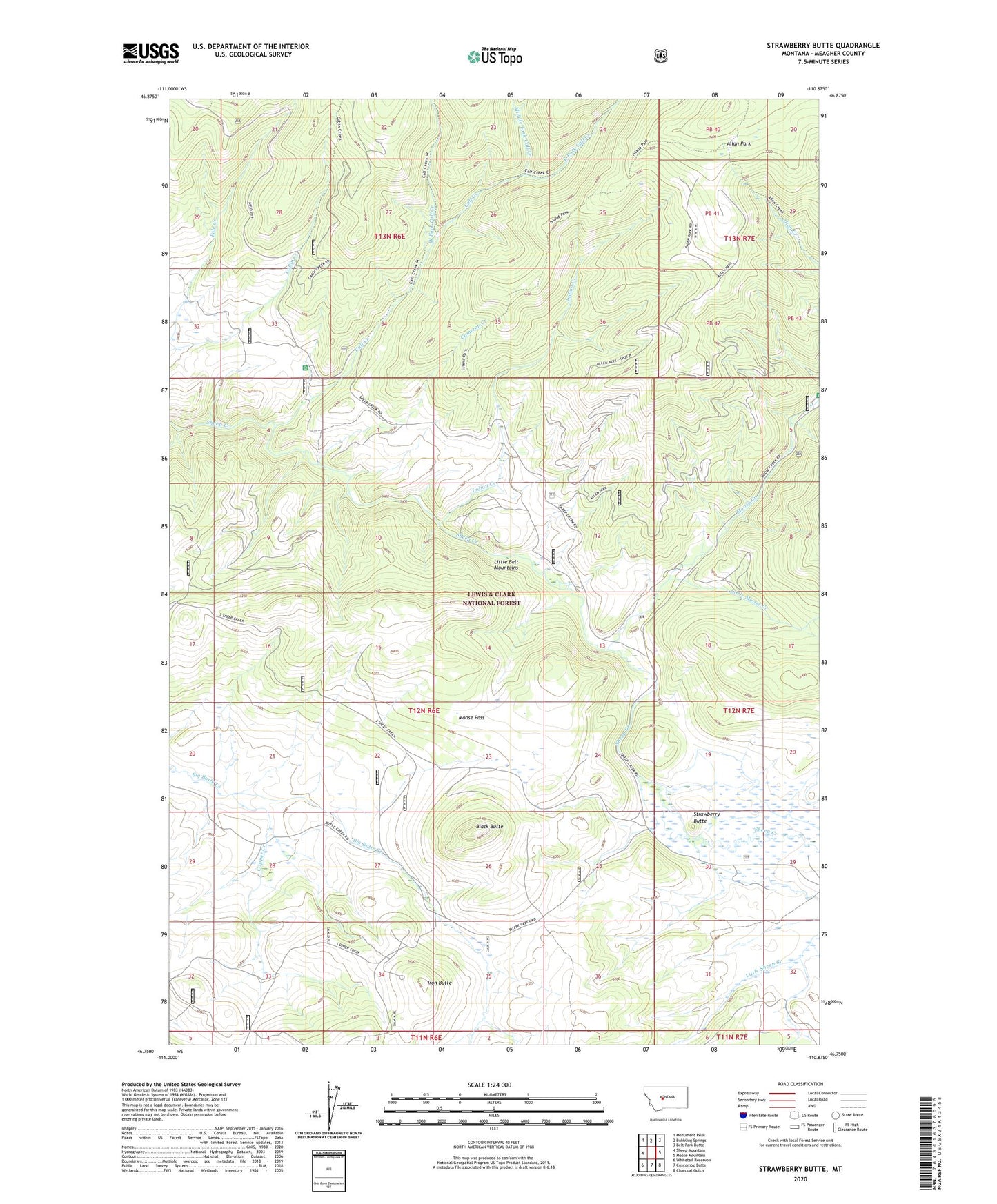
2020 topographic map quadrangle Strawberry Butte in the state of Montana. Scale: 1:24000. Based on the newly updated USGS 7.5' US Topo map series, this map is in the following counties: Meagher. The map contains contour data, water features, and other items you are used to seeing on USGS maps, but also has updated roads and other features. This is the next generation of topographic maps. Printed on high-quality waterproof paper with UV fade-resistant inks.
Quads adjacent to this one:
West: Sheep Mountain
Northwest: Monument Peak
North: Bubbling Springs
Northeast: Belt Park Butte
East: Moose Mountain
Southeast: Charcoal Gulch
South: Coxcombe Butte
Southwest: Whitetail Reservoir
Contains the following named places: Allan Park, Black Butte, Calf Creek, Calf Creek Guard Station, Cameron Creek, Copper Creek, East Fork Calf Creek, Indian Creek, Iron Butte, Iron Butte Mine, Little Moose Creek, Little Sheep Creek, Middle Fork Calf Creek, Moose Creek, Moose Pass, Sheep Creek Campground, Strawberry Butte, West Fork Calf Creek