MyTopo
Sulphur Bar Creek Montana US Topo Map
Couldn't load pickup availability
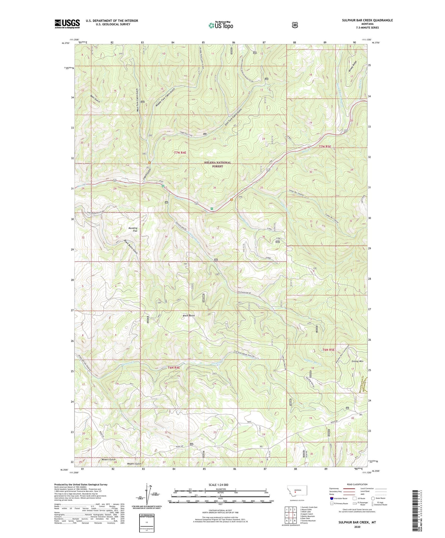
2020 topographic map quadrangle Sulphur Bar Creek in the state of Montana. Scale: 1:24000. Based on the newly updated USGS 7.5' US Topo map series, this map is in the following counties: Broadwater, Meagher. The map contains contour data, water features, and other items you are used to seeing on USGS maps, but also has updated roads and other features. This is the next generation of topographic maps. Printed on high-quality waterproof paper with UV fade-resistant inks.
Quads adjacent to this one:
West: Lippert Gulch
Northwest: Gurnett Creek East
North: Mount Edith
Northeast: Alkali Lake
East: Battle Mountain
Southeast: Francis
South: Sixmile Mountain
Southwest: Deer Park
Contains the following named places: Bigler Mine, Black Butte, Blacktail Creek, Cabin Gulch, Castle Fork, Cedar Bar Creek, Deep Creek Picnic Area, East Fork Cabin Gulch, Flathead Indian Trail, Higgins Brothers Number 2 Dam, Middle Fork Cabin Gulch, Munding Flat, Russell Fork Deep Creek, Snowbank Mine, Sulphur Bar Creek, West Fork Cabin Gulch