MyTopo
Summit Montana US Topo Map
Couldn't load pickup availability
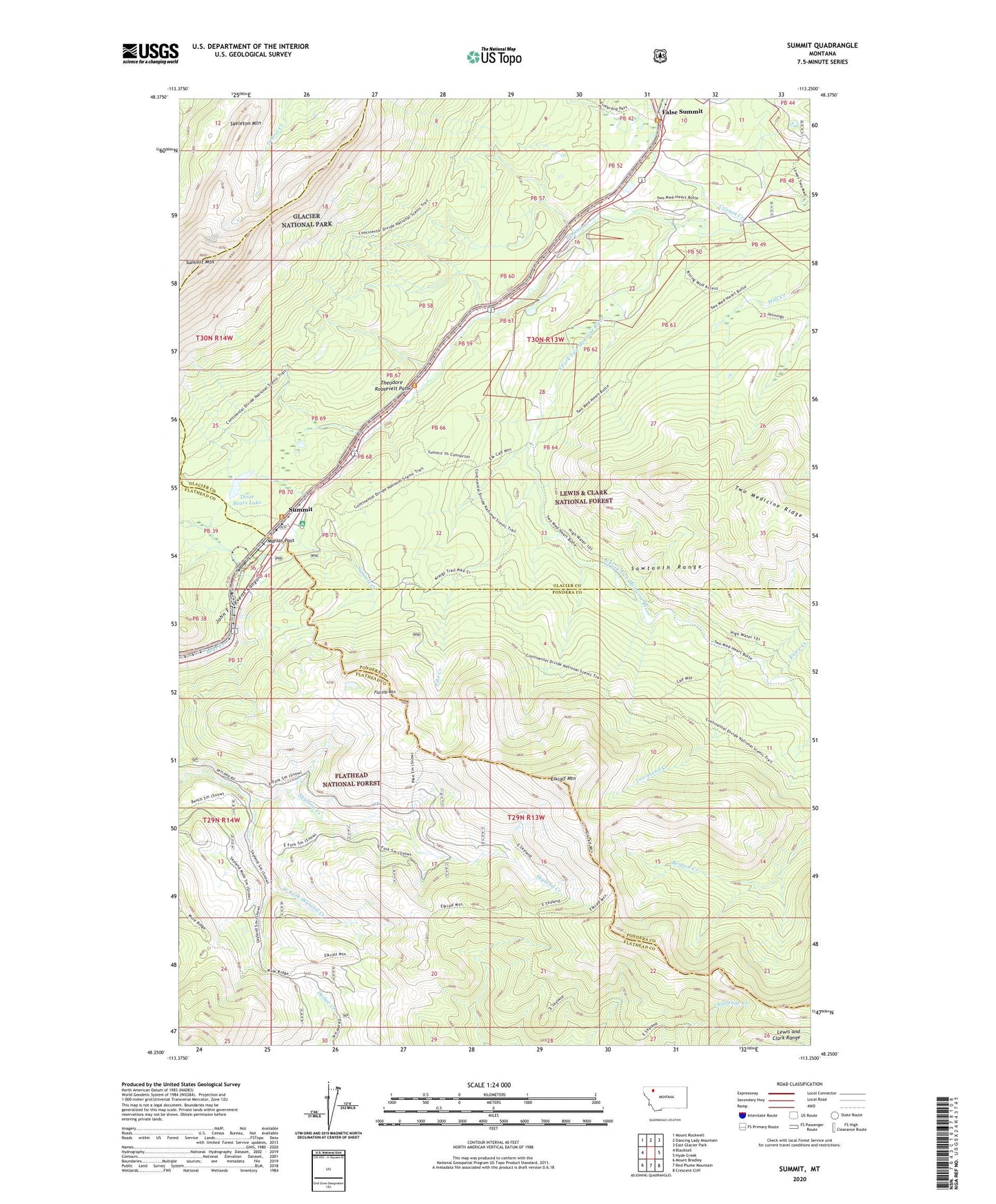
2020 topographic map quadrangle Summit in the state of Montana. Scale: 1:24000. Based on the newly updated USGS 7.5' US Topo map series, this map is in the following counties: Glacier, Flathead, Pondera. The map contains contour data, water features, and other items you are used to seeing on USGS maps, but also has updated roads and other features. This is the next generation of topographic maps. Printed on high-quality waterproof paper with UV fade-resistant inks.
Quads adjacent to this one:
West: Blacktail
Northwest: Mount Rockwell
North: Dancing Lady Mountain
Northeast: East Glacier Park
East: Hyde Creek
Southeast: Crescent Cliff
South: Red Plume Mountain
Southwest: Mount Bradley
Contains the following named places: Cataract, Coonsa Creek, Elkcalf Mountain, False Summit, Flattop Mountain, Lubec Post Office, Marias Pass, Pike Creek, Pike Post Office, Rising Wolf, Rising Wolf Resort, Roosevelt Memorial, Rowe Creek, Skeleton Mountain, Summit, Summit Campground, Summit Creek, Summit Mountain, Summit Trail, Three Bears Lake, Townsend Creek, West Fork Skyland Creek