MyTopo
Todd Lakes NE Montana US Topo Map
Couldn't load pickup availability
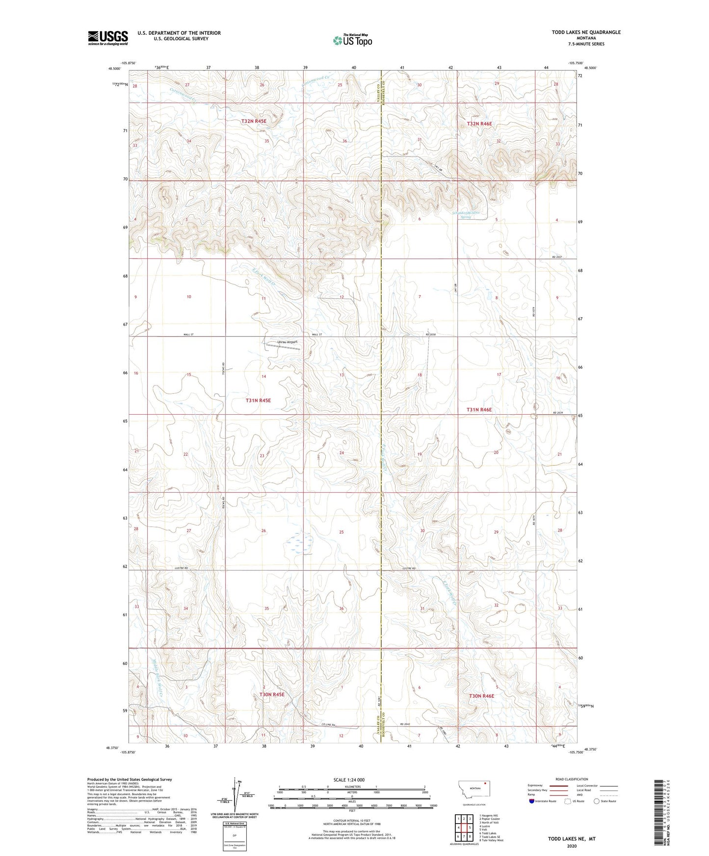
2024 topographic map quadrangle Todd Lakes NE in the state of Montana. Scale: 1:24000. Based on the newly updated USGS 7.5' US Topo map series, this map is in the following counties: Valley, Roosevelt. The map contains contour data, water features, and other items you are used to seeing on USGS maps, but also has updated roads and other features. This is the next generation of topographic maps. Printed on high-quality waterproof paper with UV fade-resistant inks.
Quads adjacent to this one:
West: Lustre
Northwest: Haugens Hill
North: Poplar Coulee
Northeast: North of Volt
East: Volt
Southeast: Tule Valley West
South: Todd Lakes SE
Southwest: Todd Lakes
This map covers the same area as the classic USGS quad with code o48105d7.
Contains the following named places: 30N45E03CCBA01 Well, 31N45E14ABCB01 Well, 31N45E15ABAA01 Well, 31N45E15DDAB01 Well, 31N45E23AA__01 Well, 31N45E25CCAB01 Well, 31N45E36BCBB01 Well, 31N46E05BCAD01 Spring, 31N46E08CBCC01 Well, 31N46E18ABBA01 Well, Dier School, Liberty School, Pleasant View School, Progressive School, Unrau Airport