MyTopo
Upper Glaston Lake Montana US Topo Map
Couldn't load pickup availability
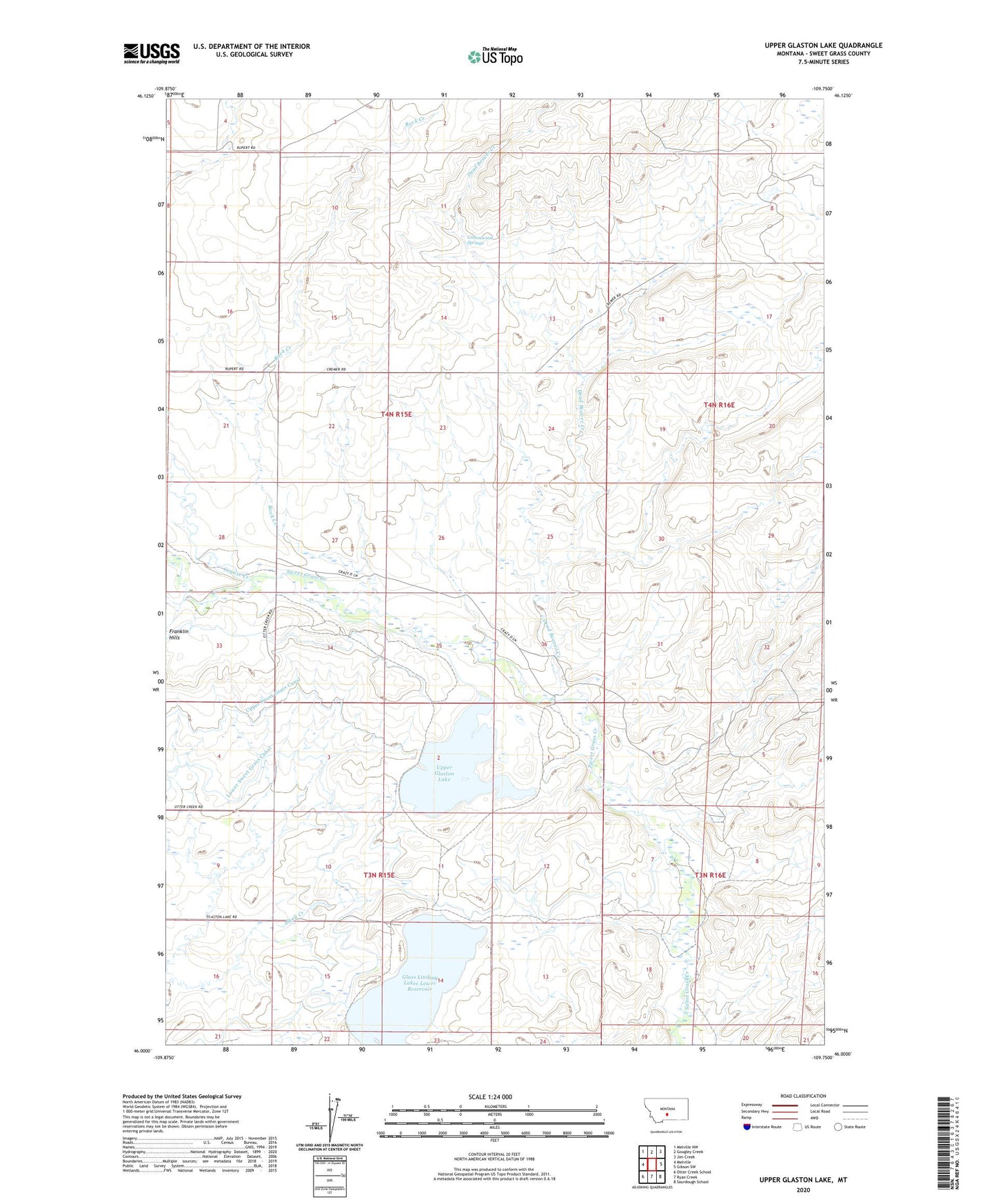
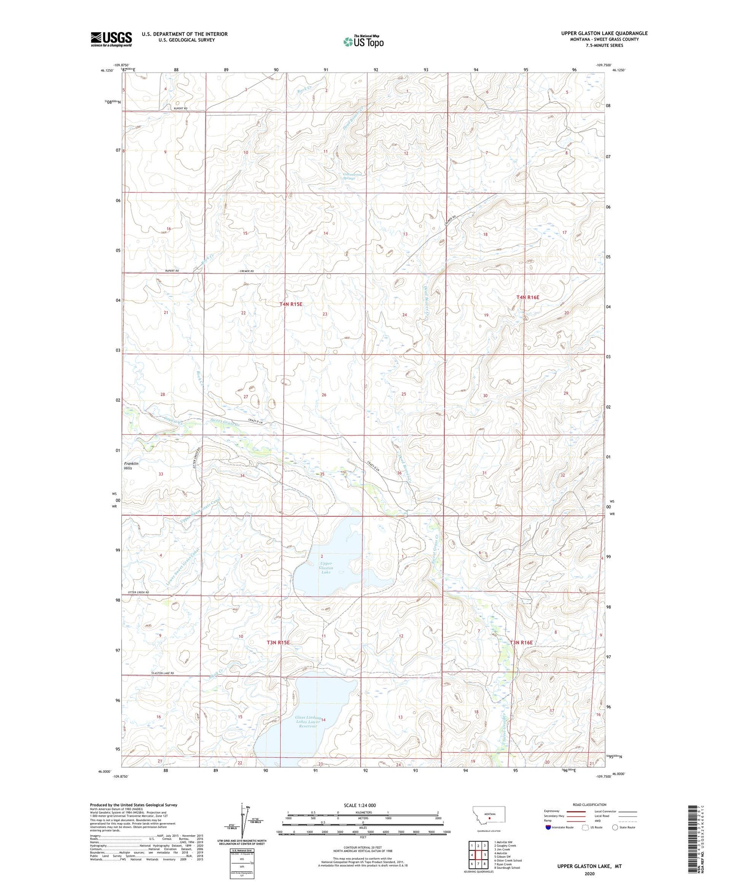
2020 topographic map quadrangle Upper Glaston Lake in the state of Montana. Scale: 1:24000. Based on the newly updated USGS 7.5' US Topo map series, this map is in the following counties: Sweet Grass. The map contains contour data, water features, and other items you are used to seeing on USGS maps, but also has updated roads and other features. This is the next generation of topographic maps. Printed on high-quality waterproof paper with UV fade-resistant inks.
Quads adjacent to this one:
West: Melville
Northwest: Melville NW
North: Gougley Creek
Northeast: Jim Creek
East: Gibson SW
Southeast: Sourdough School
South: Ryan Creek
Southwest: Otter Creek School
Contains the following named places: Cayuse Creek, Cottonwood Springs, Dead Beaver Creek, Glass Lindsay Lakes Lower Reservoir, Lake Adam East Dam, Lake Adam North Dam, Lake Adam West Dam, Lower Glaston Lake, Lower Sweet Grass Canal, Rock Creek, Upper Glaston Lake, ZIP Code: 59055