MyTopo
Vananda Montana US Topo Map
Couldn't load pickup availability
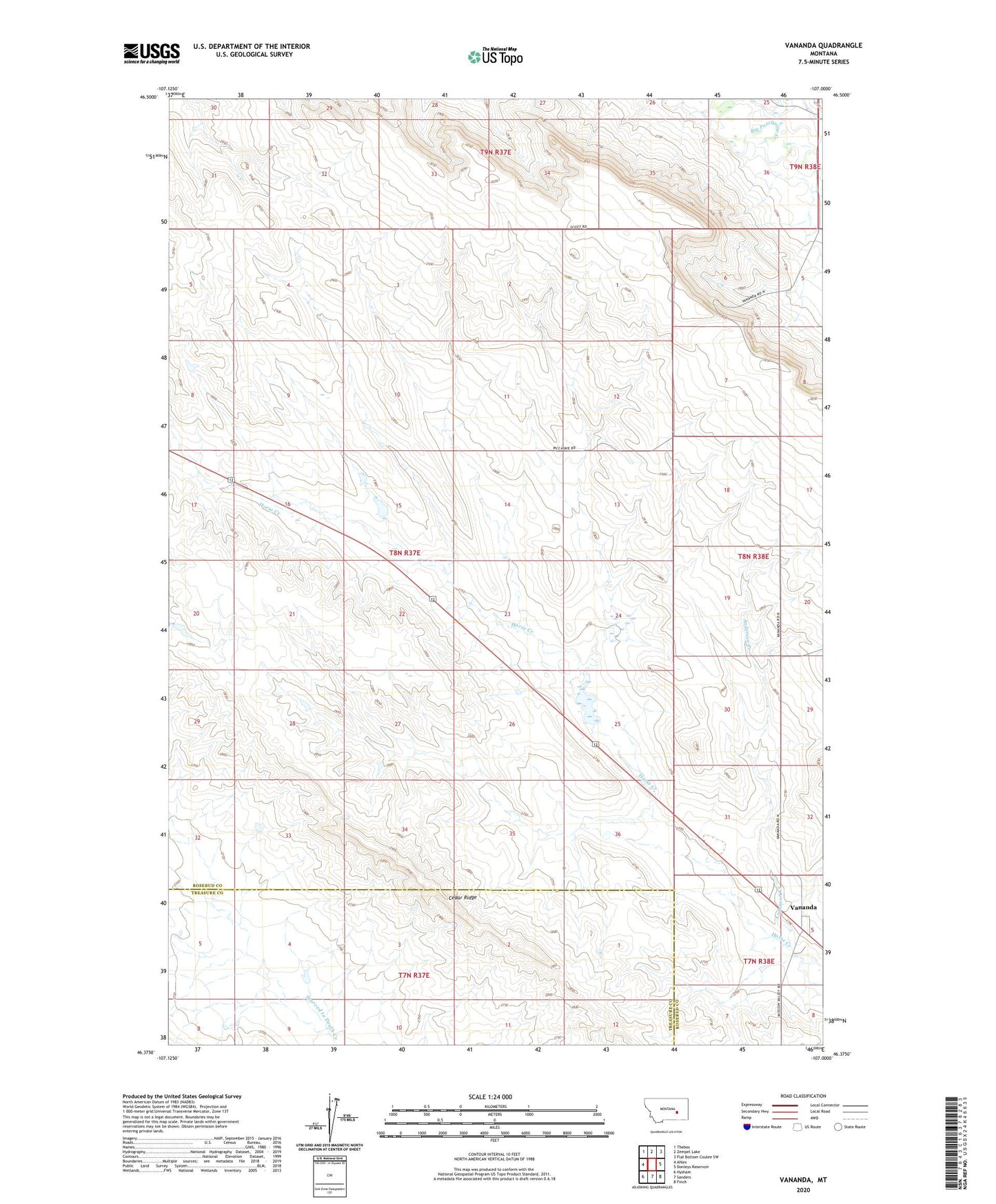
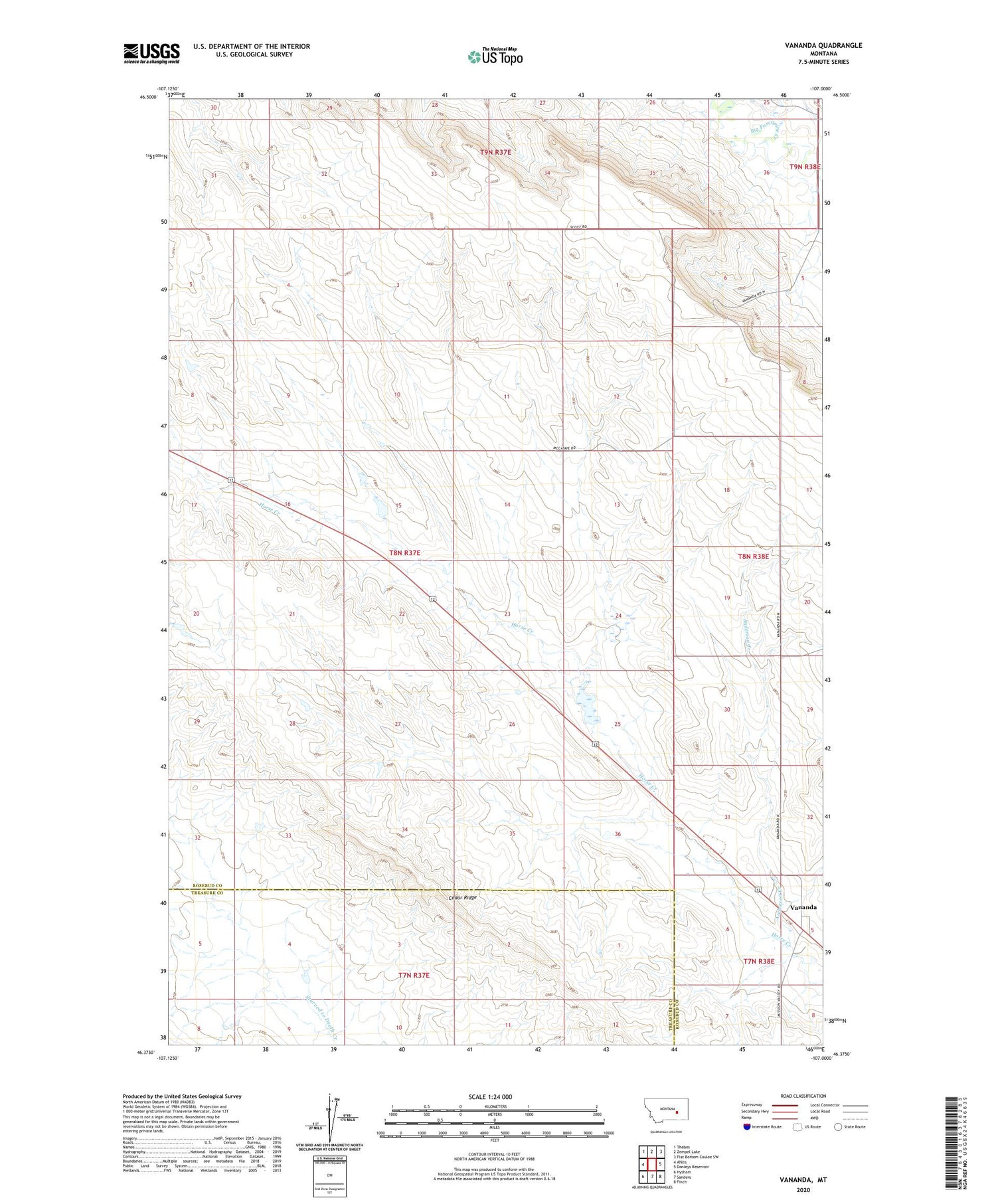
2020 topographic map quadrangle Vananda in the state of Montana. Scale: 1:24000. Based on the newly updated USGS 7.5' US Topo map series, this map is in the following counties: Rosebud, Treasure. The map contains contour data, water features, and other items you are used to seeing on USGS maps, but also has updated roads and other features. This is the next generation of topographic maps. Printed on high-quality waterproof paper with UV fade-resistant inks.
Quads adjacent to this one:
West: Ahles
Northwest: Thebes
North: Zempel Lake
Northeast: Flat Bottom Coulee SW
East: Donleys Reservoir
Southeast: Finch
South: Sanders
Southwest: Hysham
Contains the following named places: 07N38E05B___01 Well, 07N38E05BA__01 Well, 09N37E33DA__01 Well, Anderson Creek, Big Timber Number 44 Dam, Big Timber Number 47 Dam, Big Timber Number 49 Dam, Cedar Ridge, Cedar Ridge Junction Mine, NE Cedar Ridge Mine, NW Cedar Ridge Mine, Rahway, Rahway School, Roach Coulee 8 9 Mine, Vananda, Vananda Post Office, Vananda School, West Cedar Ridge Mine