MyTopo
Vandalia Montana US Topo Map
Couldn't load pickup availability
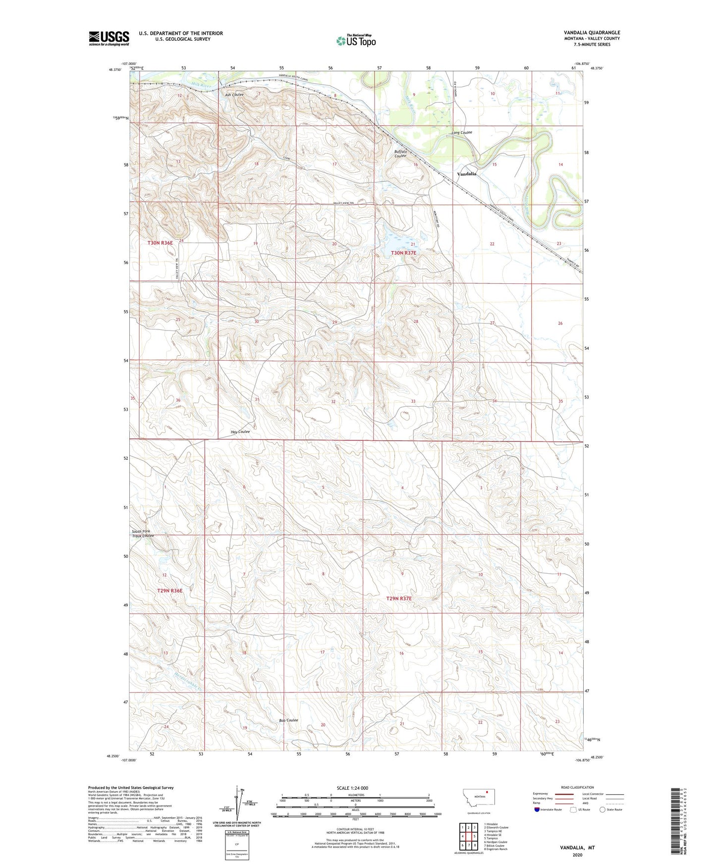
2024 topographic map quadrangle Vandalia in the state of Montana. Scale: 1:24000. Based on the newly updated USGS 7.5' US Topo map series, this map is in the following counties: Valley. The map contains contour data, water features, and other items you are used to seeing on USGS maps, but also has updated roads and other features. This is the next generation of topographic maps. Printed on high-quality waterproof paper with UV fade-resistant inks.
Quads adjacent to this one:
West: Hinsdale SE
Northwest: Hinsdale
North: Ellsworth Coulee
Northeast: Tampico NE
East: Tampico
Southeast: Engstrom Ranch
South: Billick Coulee
Southwest: Hardpan Coulee
This map covers the same area as the classic USGS quad with code o48106c8.
Contains the following named places: Ash Coulee, Bear Creek, Bob Coulee, Buffale Dam, Buffalo Coulee, Campbells Houses, Enkrud Dam, Ghost Number 2 Dam, Halverson Dam, Hamells Houses, Kirkwood, Long Coulee, Putnam, Putnam Post Office, Saint Anthony and Dakota Elevator, South Fork Traux Coulee, Sowa School, Tigar Milk Dam, Vandalia, Vandalia Dam, Vandalia Diversion Dam, Vandalia Post Office, Vandalia School