MyTopo
Volcano Butte Montana US Topo Map
Couldn't load pickup availability
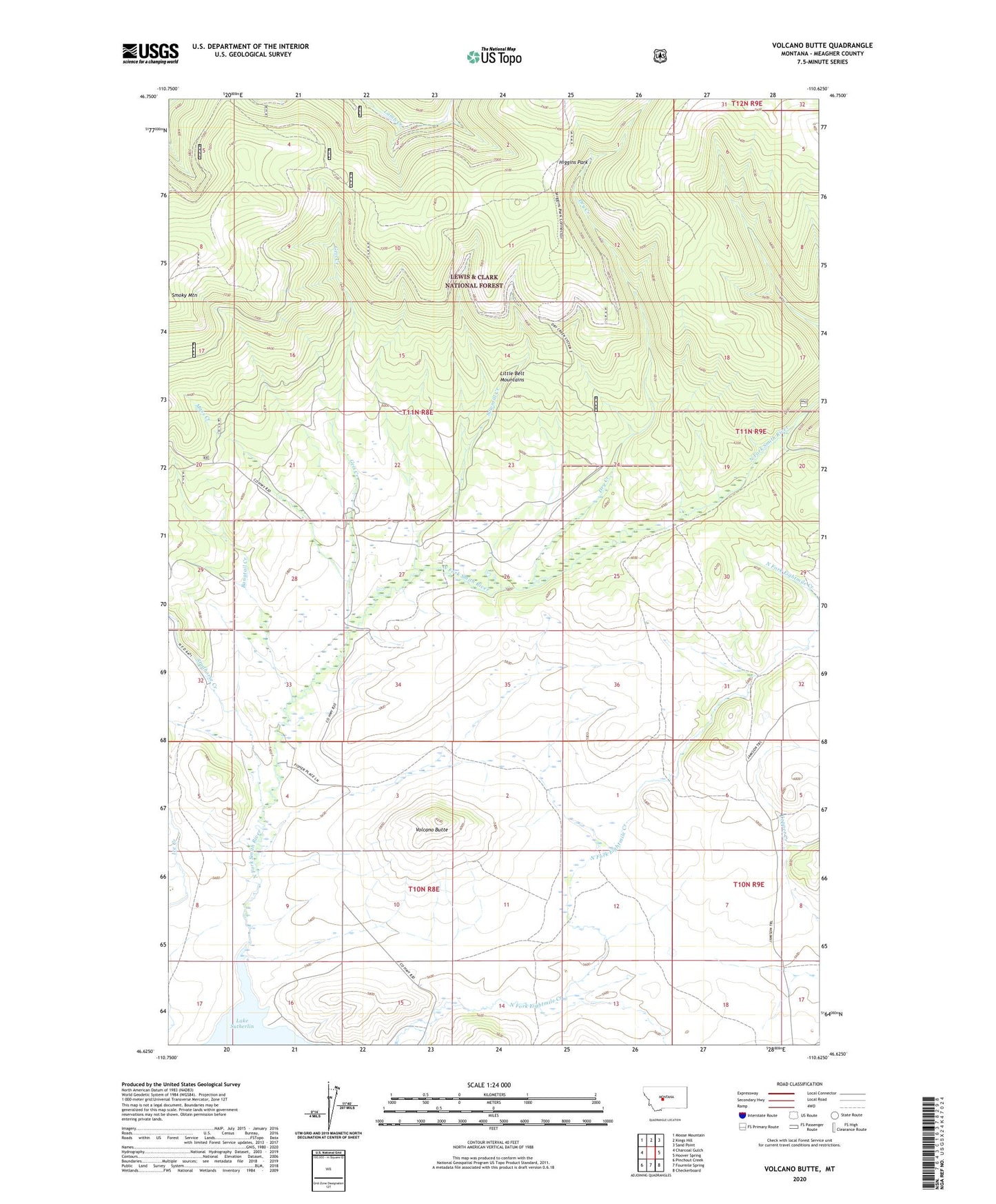
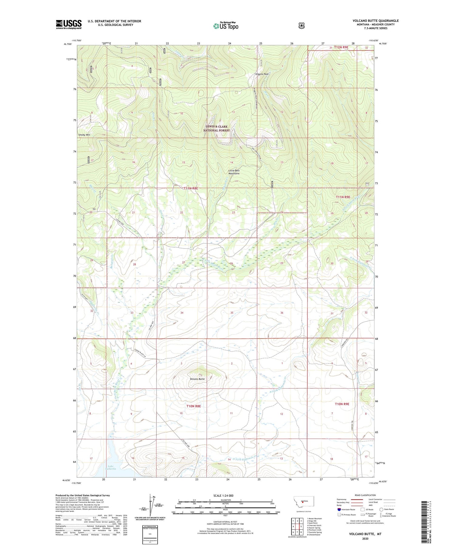
2020 topographic map quadrangle Volcano Butte in the state of Montana. Scale: 1:24000. Based on the newly updated USGS 7.5' US Topo map series, this map is in the following counties: Meagher. The map contains contour data, water features, and other items you are used to seeing on USGS maps, but also has updated roads and other features. This is the next generation of topographic maps. Printed on high-quality waterproof paper with UV fade-resistant inks.
Quads adjacent to this one:
West: Charcoal Gulch
Northwest: Moose Mountain
North: Kings Hill
Northeast: Sand Point
East: Hoover Spring
Southeast: Checkerboard
South: Fourmile Spring
Southwest: Pinchout Creek
Contains the following named places: Bangtail Creek, Copper State Mine, Dry Creek, Eightmile Creek, Geis Creek, Higgins Park, Jamison Trail, Mass Creek, North Fork Eightmile Creek, NW NE Section 22 Mine, NW NW Section 15 Mine, Sawmill Creek, South Fork Eightmile Creek, Studhorse Creek, Volcano Butte