MyTopo
Wapiti Lake Montana US Topo Map
Couldn't load pickup availability
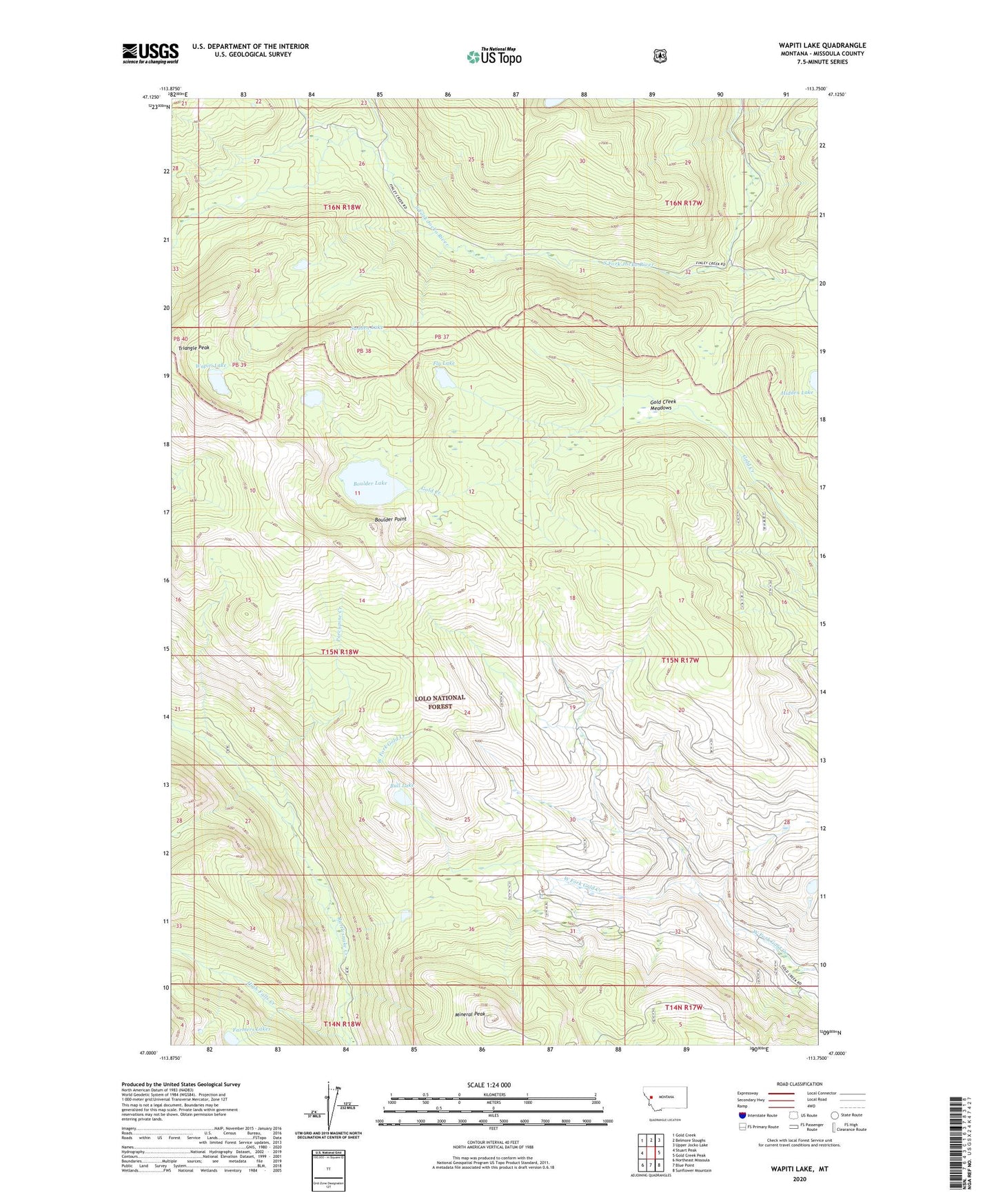
2020 topographic map quadrangle Wapiti Lake in the state of Montana. Scale: 1:24000. Based on the newly updated USGS 7.5' US Topo map series, this map is in the following counties: Missoula. The map contains contour data, water features, and other items you are used to seeing on USGS maps, but also has updated roads and other features. This is the next generation of topographic maps. Printed on high-quality waterproof paper with UV fade-resistant inks.
Quads adjacent to this one:
West: Stuart Peak
Northwest: Gold Creek
North: Belmore Sloughs
Northeast: Upper Jocko Lake
East: Gold Creek Peak
Southeast: Sunflower Mountain
South: Blue Point
Southwest: Northeast Missoula
Contains the following named places: Boulder Lake, Boulder Point, Bull Lake, Fly Lake, Gold Creek Meadows, High Falls Creek, Lake Creek, Liberty Creek, Mineral Peak, Porcupine Creek, Rattlesnake National Recreation Area, Sudden Lake, Wapiti Lake