MyTopo
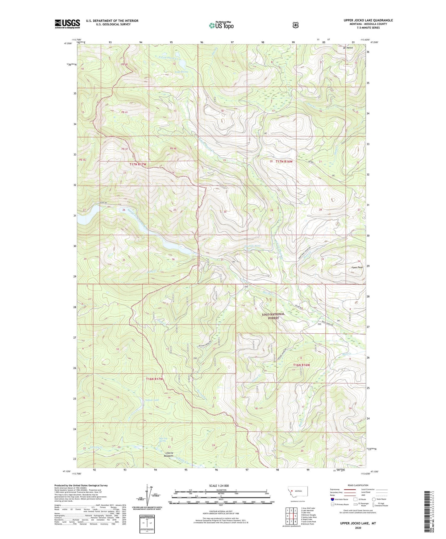
Upper Jocko Lake Montana US Topo Map
Couldn't load pickup availability
Also explore the Upper Jocko Lake Forest Service Topo of this same quad for updated USFS data
2024 topographic map quadrangle Upper Jocko Lake in the state of Montana. Scale: 1:24000. Based on the newly updated USGS 7.5' US Topo map series, this map is in the following counties: Missoula. The map contains contour data, water features, and other items you are used to seeing on USGS maps, but also has updated roads and other features. This is the next generation of topographic maps. Printed on high-quality waterproof paper with UV fade-resistant inks.
Quads adjacent to this one:
West: Belmore Sloughs
Northwest: Gray Wolf Lake
North: Lake Marshall
Northeast: Lake Inez
East: Seeley Lake West
Southeast: Belmont Point
South: Gold Creek Peak
Southwest: Wapiti Lake
This map covers the same area as the classic USGS quad with code o47113b6.
Contains the following named places: Black Lake, Black Lake Dam, Blue Jay Spring, Fawn Peak, First Creek, Grouse Creek, Horn Creek, Jocko Creek, Lake Elsina, Liberty Meadows, North Fork Placid Creek, Onemile Pond, Second Creek, Upper Jocko Lake, Yellow Lake