MyTopo
Gold Creek Montana US Topo Map
Couldn't load pickup availability
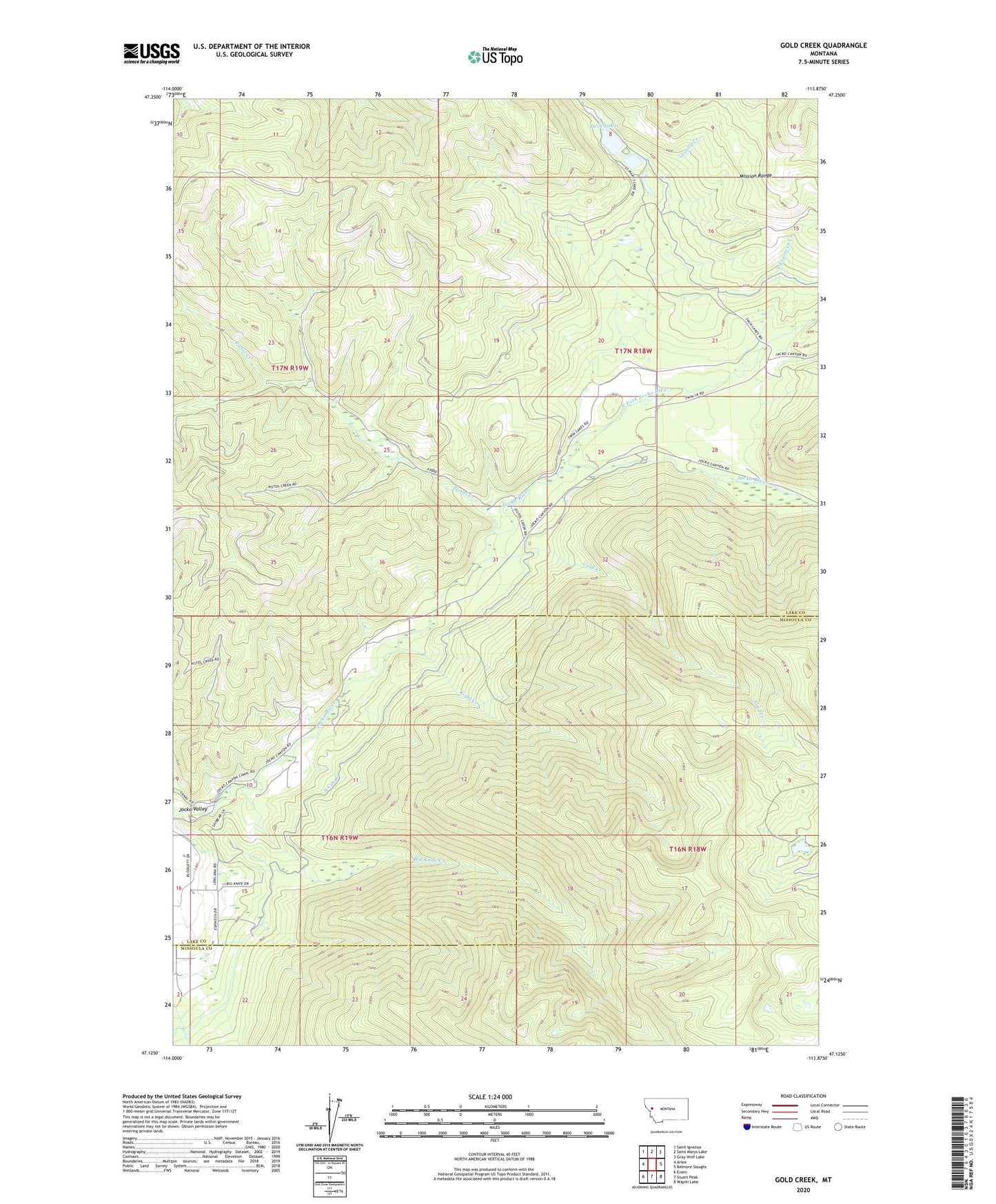
2024 topographic map quadrangle Gold Creek in the state of Montana. Scale: 1:24000. Based on the newly updated USGS 7.5' US Topo map series, this map is in the following counties: Lake, Missoula. The map contains contour data, water features, and other items you are used to seeing on USGS maps, but also has updated roads and other features. This is the next generation of topographic maps. Printed on high-quality waterproof paper with UV fade-resistant inks.
Quads adjacent to this one:
West: Arlee
Northwest: Saint Ignatius
North: Saint Marys Lake
Northeast: Gray Wolf Lake
East: Belmore Sloughs
Southeast: Wapiti Lake
South: Stuart Peak
Southwest: Evaro
This map covers the same area as the classic USGS quad with code o47113b8.
Contains the following named places: 17N18W29CAAC01 Well, Big Knife Creek, Cold Creek, Flathead Reservation Division, Gold Creek, Grizzly Creek, North Fork Jocko River, Pistol Creek, S Canal, S-Fourteen Creek, Twin Lakes