MyTopo
Belmore Sloughs Montana US Topo Map
Couldn't load pickup availability
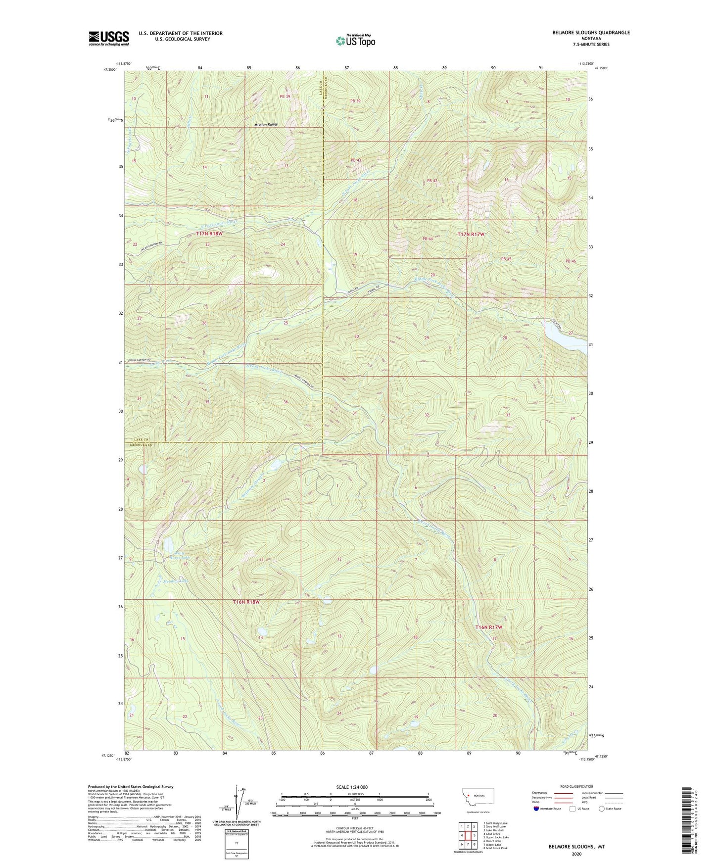
2024 topographic map quadrangle Belmore Sloughs in the state of Montana. Scale: 1:24000. Based on the newly updated USGS 7.5' US Topo map series, this map is in the following counties: Missoula, Lake. The map contains contour data, water features, and other items you are used to seeing on USGS maps, but also has updated roads and other features. This is the next generation of topographic maps. Printed on high-quality waterproof paper with UV fade-resistant inks.
Quads adjacent to this one:
West: Gold Creek
Northwest: Saint Marys Lake
North: Gray Wolf Lake
Northeast: Lake Marshall
East: Upper Jocko Lake
Southeast: Gold Creek Peak
South: Wapiti Lake
Southwest: Stuart Peak
This map covers the same area as the classic USGS quad with code o47113b7.
Contains the following named places: Belmore Sloughs, Cedar Campground, Deep Creek, Falls Creek, Jocko Dam, Jocko Lookout, Lower Jocko Lake, Meadow Lake, Middle Fork Jocko River, South Fork Jocko River, Twin Campground, White Horse Lake