MyTopo
West Valley Montana US Topo Map
Couldn't load pickup availability
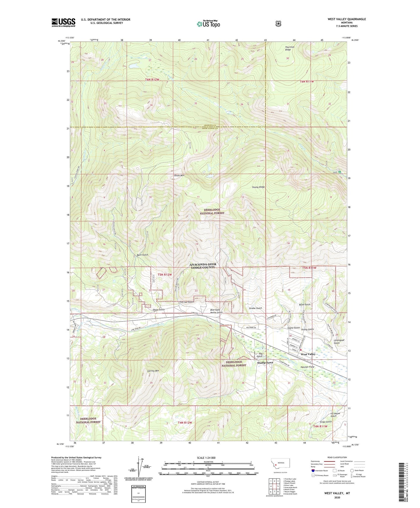
2020 topographic map quadrangle West Valley in the state of Montana. Scale: 1:24000. Based on the newly updated USGS 7.5' US Topo map series, this map is in the following counties: Deer Lodge, Granite. The map contains contour data, water features, and other items you are used to seeing on USGS maps, but also has updated roads and other features. This is the next generation of topographic maps. Printed on high-quality waterproof paper with UV fade-resistant inks.
Quads adjacent to this one:
West: Silver Lake
Northwest: Fred Burr Lake
North: Pozega Lakes
Northeast: Mount Powell
East: Anaconda North
Southeast: Anaconda South
South: Mount Haggin
Southwest: Mount Evans
Contains the following named places: 05N11W29DCDA01 Well, 05N11W30DDCA01 Well, Balkan Mine, Barker Creek, Big Gulch, Blue Eyed Nellie Gulch, Blue Eyed Nellie Mine, Brown, Buck Gulch, Buck Gulch Mine, Bund Gulch, Foster Creek, Garrity Mountain, Geary Gulch, George Mines, Gladstone Mine, Grays Gulch, Hatcher Field, Homestake Mine, Ice House Gulch, Keystone Mine, Levengood Gulch, Lorenz, Lost Creek Campground, Lost Creek State Park, Meyers Dam, Mohawk Mine, Mount Haggin Baptist Church, Mountain View Mine, Mountain View Spur, NW NE Section 2 Mine, NW NE Section 36 Mine, NW NW Section 2 Mine, NW NW Section 25 Mine, Olson Gulch, Olson Mountain, Priebe Gulch, SE NE Section 14 Mine, SE NW Section 24 Mine, SE NW Section 26 Mine, SE SW Section 22 Mine, Sheridan Mine, Stamptown, Stucky Gulch, Stucky Ridge, Stump Town, SW NW Section 10 Mine, SW SW Section 21 Mine, SW SW Section 27 Mine, Tin Can Gulch, West Valley, West Valley Anaconda Volunteer Fire Department