MyTopo
Pozega Lakes Montana US Topo Map
Couldn't load pickup availability
Also explore the Pozega Lakes Forest Service Topo of this same quad for updated USFS data
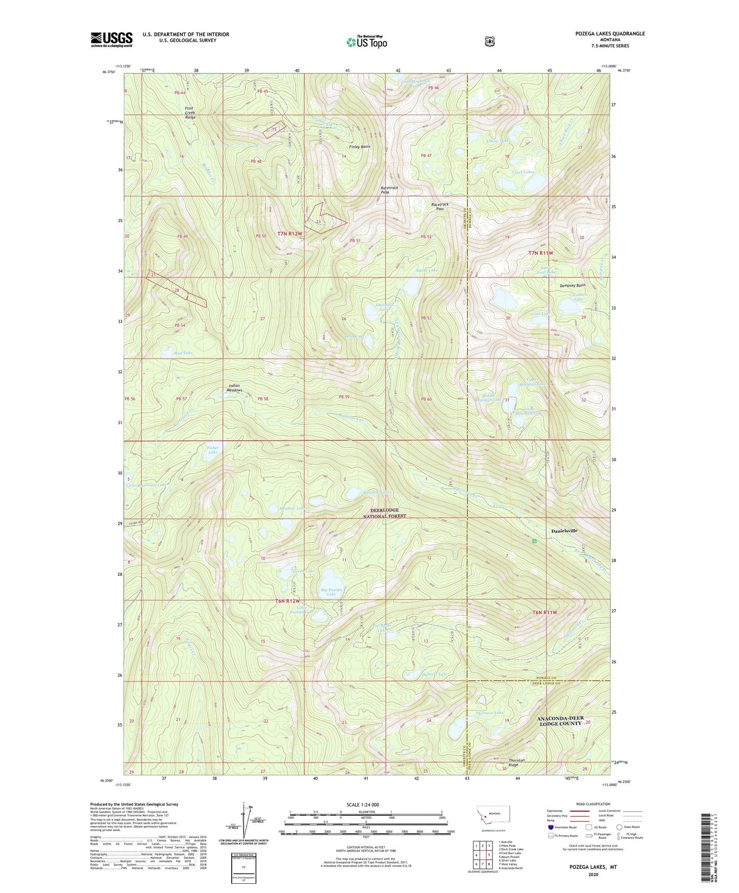
2024 topographic map quadrangle Pozega Lakes in the state of Montana. Scale: 1:24000. Based on the newly updated USGS 7.5' US Topo map series, this map is in the following counties: Granite, Powell, Deer Lodge. The map contains contour data, water features, and other items you are used to seeing on USGS maps, but also has updated roads and other features. This is the next generation of topographic maps. Printed on high-quality waterproof paper with UV fade-resistant inks.
Quads adjacent to this one:
West: Fred Burr Lake
Northwest: Maxville
North: Pikes Peak
Northeast: Rock Creek Lake
East: Mount Powell
Southeast: Anaconda North
South: West Valley
Southwest: Silver Lake
This map covers the same area as the classic USGS quad with code o46113c1.
Contains the following named places: Albicaulis Lake, Albicaulis Lake Dam, Alpine Lake, Alpine Lake Dam, Big Pozega Lake, Boulder Lakes Trail, Bowman Lake Number 1 Dam, Bowman Lake Number 2 Dam, Bowman Lake Number 3 Dam, Bowman Lakes, Caruthers Lake, Caruthers Lake Dam, Daniels Post Office, Danielsville, Dead Lake, Dempsey Basin, Elbow Lake, Finley Basin, Fisher Lake, Fisher Lake Dam, Goat Lake, Goat Lake Dam, Green Lake, Hunters Lake, Indian Meadows, Little Goat Lake, Little Pozega Lake, Little Racetrack Lake, Lower Bowman Lake, Meadow Lakes, Middle Bowman Lake, Mountain Ben Dam, Mountain Ben Lake, Mud Lake, Mud Lake Dam, North Fork Racetrack Creek, Porcupine Lake, Powell Mine, Powell Mines, Pozega Lake Number 1 Dam, Pozega Lake Number 2 Dam, Pozega Lake Number 3 Dam, Pozega Lakes, Racetrack Pass, Racetrack Peak, Thornton Lake, Thornton Lake Dam, Thornton Ridge, Trask Lakes, Tungsten, Upper Bowman Lake