MyTopo
Mount Powell Montana US Topo Map
Couldn't load pickup availability
Also explore the Mount Powell Forest Service Topo of this same quad for updated USFS data
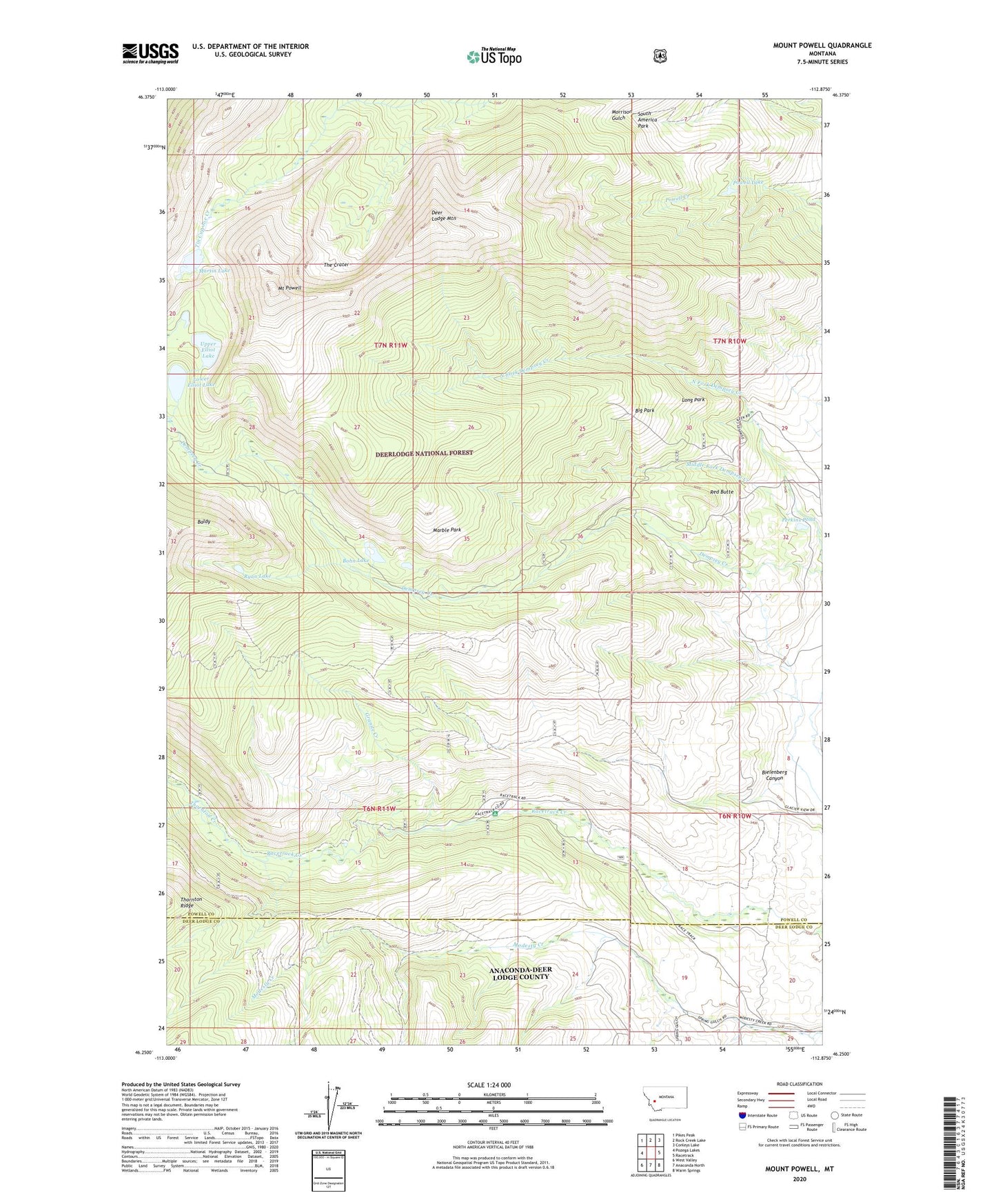
2024 topographic map quadrangle Mount Powell in the state of Montana. Scale: 1:24000. Based on the newly updated USGS 7.5' US Topo map series, this map is in the following counties: Powell, Deer Lodge. The map contains contour data, water features, and other items you are used to seeing on USGS maps, but also has updated roads and other features. This is the next generation of topographic maps. Printed on high-quality waterproof paper with UV fade-resistant inks.
Quads adjacent to this one:
West: Pozega Lakes
Northwest: Pikes Peak
North: Rock Creek Lake
Northeast: Conleys Lake
East: Racetrack
Southeast: Warm Springs
South: Anaconda North
Southwest: West Valley
This map covers the same area as the classic USGS quad with code o46112c8.
Contains the following named places: 06N10W08AC__01 Well, 06N10W20DC__01 Well, Baldy, Bielenberg Canyon, Big Park, Bohn Lake, Bohn Lake Dam, Deer Lodge Mountain, Flint Creek Range, Granite Creek, Long Park, Lower Elliot Lake, Lower Elliot Lake Dam, Marble Park, Martin Lake, Martin Lake Dam, Middle Fork Dempsey Creek, Mount Powell, Perkins Pond, Powell Lake, Racetrack Campground, Red Butte, Ryan Lake, The Crater, Thornton Creek, Upper Elliot Lake