MyTopo
Westmore Montana US Topo Map
Couldn't load pickup availability
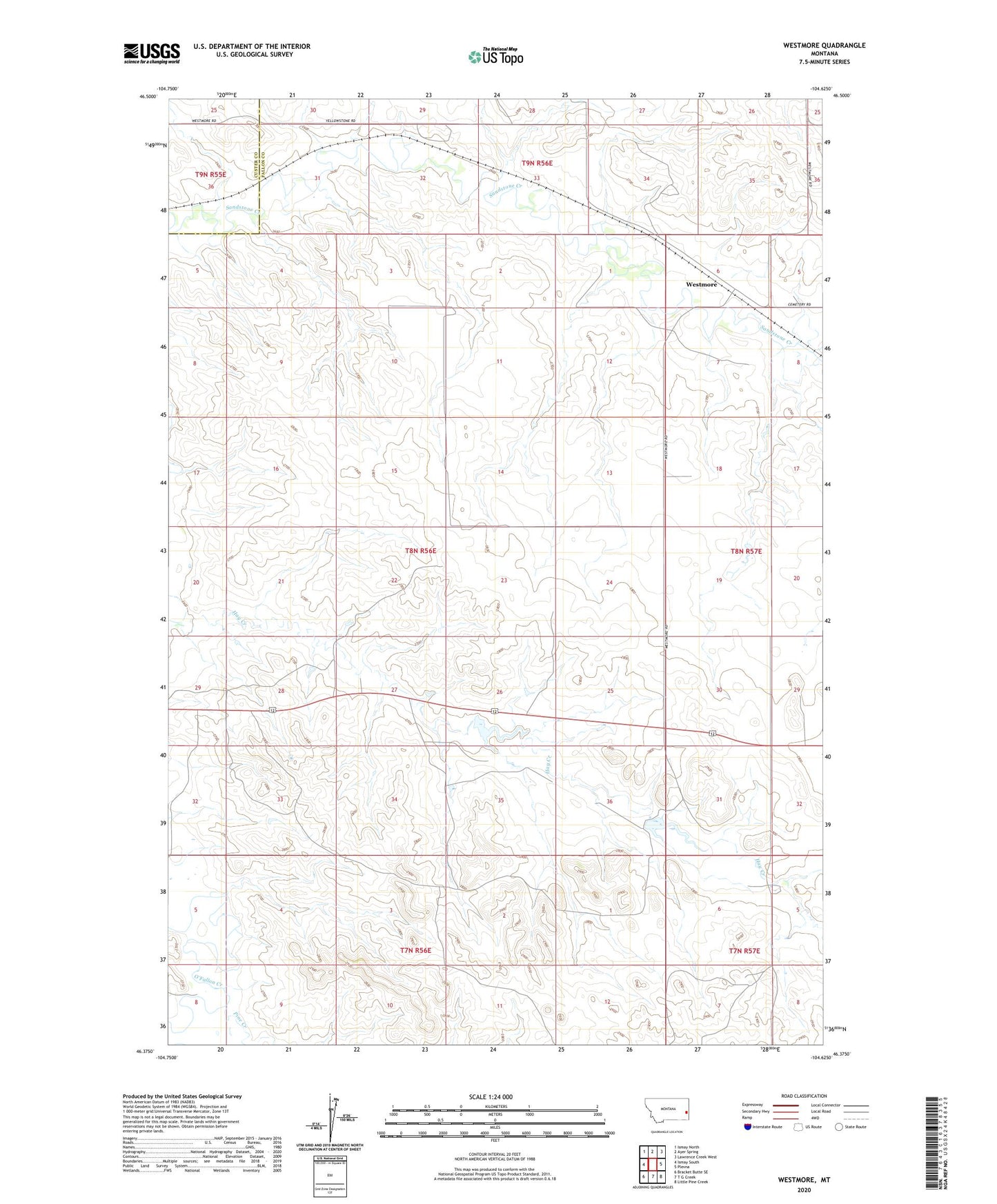
2024 topographic map quadrangle Westmore in the state of Montana. Scale: 1:24000. Based on the newly updated USGS 7.5' US Topo map series, this map is in the following counties: Fallon, Custer. The map contains contour data, water features, and other items you are used to seeing on USGS maps, but also has updated roads and other features. This is the next generation of topographic maps. Printed on high-quality waterproof paper with UV fade-resistant inks.
Quads adjacent to this one:
West: Ismay South
Northwest: Ismay North
North: Ayer Spring
Northeast: Lawrence Creek West
East: Plevna
Southeast: Little Pine Creek
South: T G Creek
Southwest: Bracket Butte SE
This map covers the same area as the classic USGS quad with code o46104d6.
Contains the following named places: 07N57E06AC__01 Well, 08N56E01BB__01 Well, 08N56E01CAAD01 Well, 08N56E10AB__01 Well, 08N56E15AD__01 Well, 08N56E25DC__01 Well, 08N56E27BCDA01 Well, 08N56E29AC__01 Well, 08N56E29CDA_01 Well, 08N56E34ACA_01 Well, 08N57E05CCAD01 Well, 08N57E06CDDC01 Well, 08N57E06DBCA01 Well, 08N57E18BC__01 Well, 08N57E20CC__01 Well, 08N57E32BA__01 Well, 09N55E25CD__01 Well, 09N55E25DC__01 Well, 09N56E28DDBC01 Well, 09N56E30DDDD01 Well, 09N56E31DA__01 Well, Columbia Elevator, Congregational Church, Ehret Land Reservoir Dam, Farmers Elevator, Pine Creek, Plevna Division, Westmore, Westmore Post Office, Westmore School