MyTopo
Lawrence Creek West Montana US Topo Map
Couldn't load pickup availability
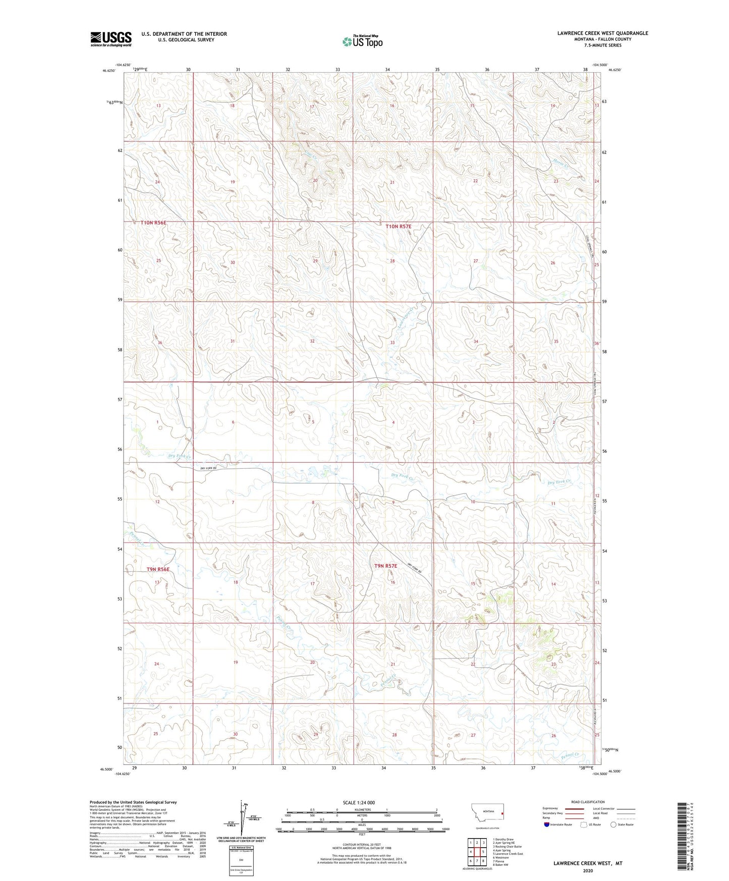
2024 topographic map quadrangle Lawrence Creek West in the state of Montana. Scale: 1:24000. Based on the newly updated USGS 7.5' US Topo map series, this map is in the following counties: Fallon. The map contains contour data, water features, and other items you are used to seeing on USGS maps, but also has updated roads and other features. This is the next generation of topographic maps. Printed on high-quality waterproof paper with UV fade-resistant inks.
Quads adjacent to this one:
West: Ayer Spring
Northwest: Dorothy Draw
North: Ayer Spring NE
Northeast: Rocking Chair Butte
East: Lawrence Creek East
Southeast: Baker NW
South: Plevna
Southwest: Westmore
This map covers the same area as the classic USGS quad with code o46104e5.
Contains the following named places: 09N56E13ADBB01 Well, 09N57E02DB__01 Well, 09N57E05DD__01 Well, 09N57E06DCDC01 Well, 09N57E06DD__01 Well, 09N57E07BBAA01 Well, 09N57E08BB__01 Well, 09N57E10DD__01 Well, 09N57E18CBBB01 Well, 10N57E26CD__01 Well, 10N57E28AD__01 Well, 10N57E28DD__01 Well, 10N57E33CB__01 Well, Lawrence Creek, Ohlrick Dam, Oscar Number 6 Dam