MyTopo
Willow Creek Montana US Topo Map
Couldn't load pickup availability
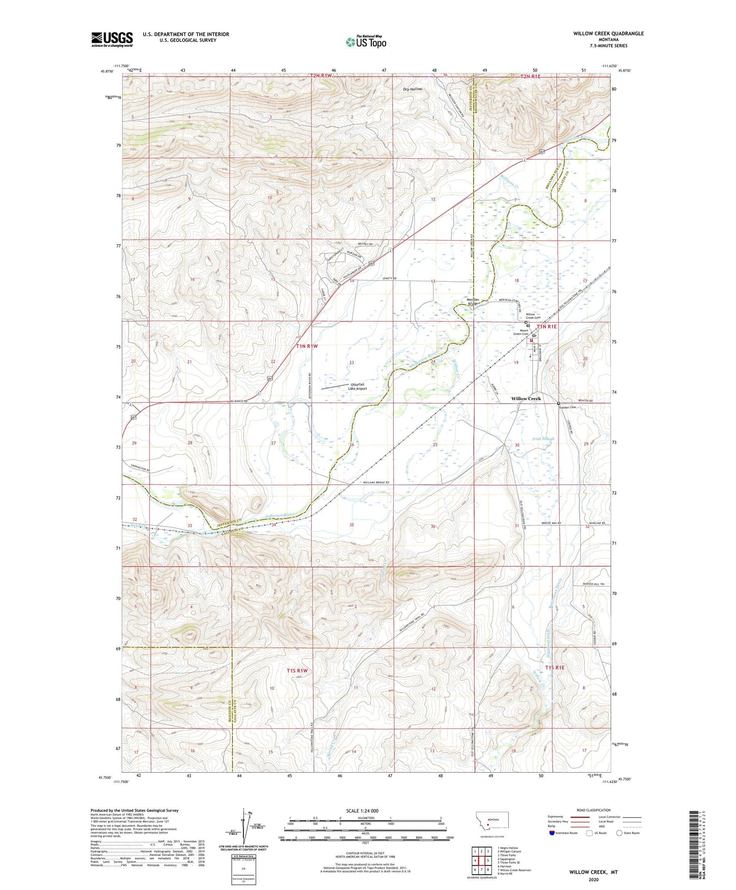
2024 topographic map quadrangle Willow Creek in the state of Montana. Scale: 1:24000. Based on the newly updated USGS 7.5' US Topo map series, this map is in the following counties: Gallatin, Jefferson, Broadwater, Madison. The map contains contour data, water features, and other items you are used to seeing on USGS maps, but also has updated roads and other features. This is the next generation of topographic maps. Printed on high-quality waterproof paper with UV fade-resistant inks.
Quads adjacent to this one:
West: Sappington
Northwest: Negro Hollow
North: Milligan Canyon
Northeast: Three Forks
East: Three Forks SE
Southeast: Norris NE
South: Willow Creek Reservoir
Southwest: Harrison
This map covers the same area as the classic USGS quad with code 072f04_1.
Contains the following named places: 01N01E19DDCB01 Well, 01N01W13BCCC01 Well, 01N01W13BDDD01 Well, 01N01W27AAAB01 Well, 01N01W27BBAA01 Well, 01N01W27BBAA02 Well, 01N01W28BBA_01 Well, 01S01E05BBCD01 Well, 59760, Buttleman Ditch, Church of Christ, Dry Hollow, Highland Ditch, Ingelside Quarry, Ingleside Quarry, Irish Slough, Jefferson School, Meridan Bridge, Milligan Canyon, Milligan Creek, Mount Green Cemetery, Ottertail Lake Airport, Parker Homestead State Park, Sand Creek, Spiritualist Church, Spring Creek, Stateler Cemetery, Stateler Monument, Three Forks Area Ambulance Station 2 - Willow Creek, Williams Bridge Fishing Access Site, Willow Creek, Willow Creek Cemetery, Willow Creek Census Designated Place, Willow Creek Methodist Church, Willow Creek Post Office, Willow Creek Public Schools, Willow Creek Rural Fire District