MyTopo
Sappington Montana US Topo Map
Couldn't load pickup availability
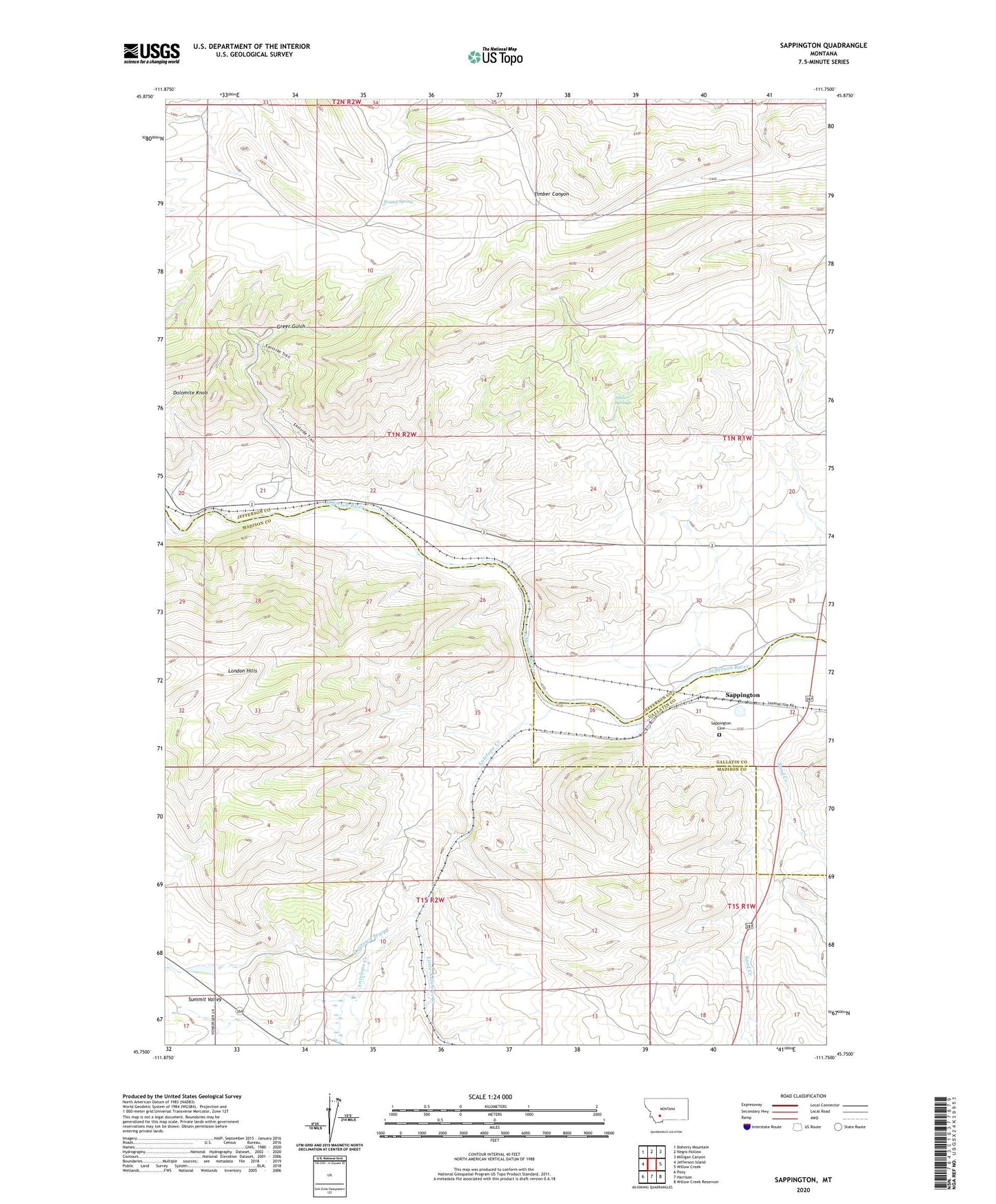
2024 topographic map quadrangle Sappington in the state of Montana. Scale: 1:24000. Based on the newly updated USGS 7.5' US Topo map series, this map is in the following counties: Jefferson, Madison, Gallatin. The map contains contour data, water features, and other items you are used to seeing on USGS maps, but also has updated roads and other features. This is the next generation of topographic maps. Printed on high-quality waterproof paper with UV fade-resistant inks.
Quads adjacent to this one:
West: Jefferson Island
Northwest: Doherty Mountain
North: Negro Hollow
Northeast: Milligan Canyon
East: Willow Creek
Southeast: Willow Creek Reservoir
South: Harrison
Southwest: Pony
This map covers the same area as the classic USGS quad with code o45111g7.
Contains the following named places: 01N01W31BDDA01 Well, Alcazar, Antelope Creek, Cavern Post Office, Clark Ranch, Dogtown Sewer, Dolomite Knob, George Hemund Dam, Greer Gulch, Harrison Highway Mine, Hemund Dam, Hubbard, Huller Springs, Lamb Ranch, Lewis and Clark Caverns Campground, Little Antelope Creek, London Hills, NE NE Section 20 Mine, NE SE Section 8 Mine, NW SE Section 7 Mine, Round Spring, Sandcreek Post Office, Sappington, Sappington Bridge Fishing Access Site, Sappington Cemetery, Sappington Mica Mine, Sappington Post Office, Sappington School, SE SW Section 24 Mine, Woodward Ranch